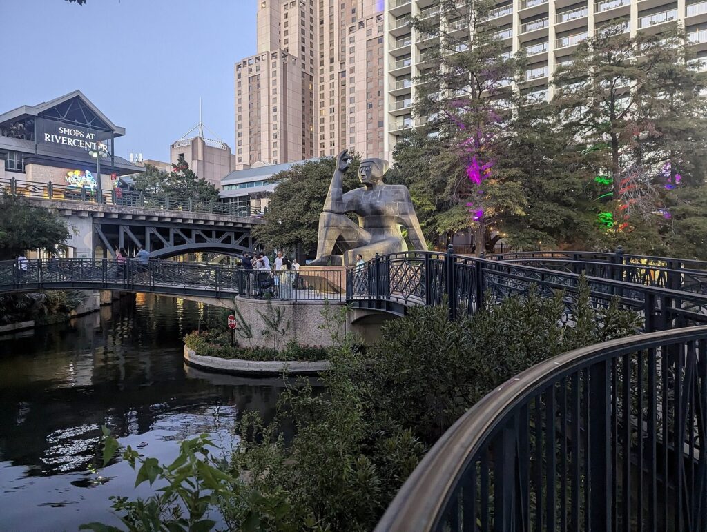
The San Antonio River Walk is a free public park that follows the San Antonio River for 15 miles, about five of them through downtown, where the path runs a story below the streets. Most visitors only see the downtown loop near the Alamo, which is the busiest and shadiest stretch. North of it, the Museum Reach carries the path past the San Antonio Museum of Art to the Pearl. To the south, the Mission Reach follows restored riverbanks to four Spanish colonial missions whose churches still hold Mass. Pick your reach by the day you want: patios and boats, a quiet walk with public art, or a long bike ride with history at every stop.
This guide is for first-time visitors who would rather plan the River Walk than drift into its most crowded hour. The caveat that shapes every choice is heat. From June through August the average high runs 92 to 96°F, and the Museum and Mission reaches have much less shade than the loop, so walk them early and save the loop for the evening. Hours, access details and fares were checked September 23, 2026 against the River Walk’s own site, the City of San Antonio, the National Park Service, Go Rio River Cruises and the other official sources listed at the end.
| At a glance | Downtown loop | Museum Reach | Mission Reach |
|---|---|---|---|
| Cost | Free; boats, food and attractions extra | Free; museum admission and Pearl shopping extra | Free, and so are the missions and their parking |
| Hours | 24 hours | 24 hours | Dawn to dusk |
| Time needed | An hour to walk it, 2 to 3 hours with side trips | Half a day with the Pearl | Half a day by bike |
| Time outdoors | All of it, mostly in shade | All of it, with patchy shade | All of it, with long unshaded stretches |
| Best time to go | Evening, or before 10 a.m. for quiet | Morning; Saturday for the farmers market | Early morning, October to April |
| Book ahead? | No; river cruises take walk-ups | No | No, but skip it after heavy rain |
How is the River Walk laid out?
Think of it as three parks sharing one river, each with its own mood, hours and amount of shade. You’ll see the name written River Walk and Riverwalk; the official version is two words, and in Spanish it’s the Paseo del Río.
The Downtown Reach
This is the original River Walk, the one on the postcards. Its core is a tight horseshoe bend of the river that everyone calls the loop, with a straight channel branching east to the convention center and the Shops at Rivercenter. Stone paths line both banks, arched footbridges cross it again and again, and restaurant patios crowd the outer edge of the bend. From the loop, paths continue north past the Tobin Center for the Performing Arts and south toward the King William neighborhood. You reach the river by stairs from most street bridges, or by a smaller number of ramps and elevators.
The Museum Reach
Opened in May 2009, the Museum Reach extends the River Walk north from Lexington Avenue to the Pearl, 1.3 miles each way by the City’s count. A lock at Brooklyn Avenue lifts boats about 9 feet so they can make the whole trip. It’s quieter than downtown, lined with public art, and it passes the San Antonio Museum of Art on the way.
The Mission Reach
South of downtown, the restored Mission Reach looks nothing like the loop: grassy banks, wide water, big sky and a paved hike-and-bike trail. The National Park Service counts about 10 miles of trail linking the four missions of San Antonio Missions National Historical Park and running north toward the Alamo. It’s open from dawn to dusk only, and unlike downtown, it can flood.
The Downtown and Museum reaches are open 24 hours. Businesses on the river keep their own hours, though, so an open path at 2 a.m. doesn’t mean anything on it is open.
Which San Antonio River Walk route should you take?
Pick one route per outing. Stringing all three reaches together on foot works on paper and flattens most people in practice, especially from May to September. The walking times below come from OpenStreetMap street routing from Alamo Plaza; the river path winds more than the streets do, so treat them as minimums.
| Route | Where to start | Distance or time | Shade | Step-free access | Best for |
|---|---|---|---|---|---|
| The downtown loop | Paseo del Alamo, or the Shops at Rivercenter | About an hour at a stroll | Heavy: cypress canopy and tall buildings | Yes at both starts; many other entrances are stairs only | A first evening, dinner, the boat ride |
| The loop plus La Villita and Hemisfair | Same starts; climb out at La Villita | 2 to 3 hours. La Villita is 10 minutes from the Alamo on foot, the Tower of the Americas 16 | Good on the river, sunny at Hemisfair | Check your exit on the City’s River Bend ADA map | Families, the tower view, shopping |
| Downtown to the Pearl | The north end of the loop, then the Museum Reach at Lexington Avenue | 1.3 miles on the Museum Reach alone; half a day with stops. The street route from the Alamo is 1.5 miles, 33 minutes | Patchy | Check the City’s North Path and Museum Reach ADA maps | Public art, the lock, the Pearl’s market and restaurants |
| South to King William and Blue Star | The south end of the loop | 1.4 miles, about 31 minutes from the Alamo by street | Mixed | Call the City’s Disability Access Office before you go | Historic homes, galleries, First Friday |
| The Mission Reach by bike | Mission Concepción or Confluence Park | About 6.5 miles from Concepción to Espada, one way | Little | Paved trail; free parking at each mission | History, cycling, birds, quiet |
| A river cruise | Go Rio booths at Rivercenter, Historia or Aztec | 35 minutes | Open-top boats, sun on the water | Ask Go Rio when you buy | A first-day overview |
If you want the short version, match your situation to one of these:
- One evening: walk the loop, take the 35-minute boat ride, then catch The Saga on San Fernando Cathedral at 9 p.m. (Tuesday to Sunday).
- One free morning: walk the Museum Reach to the Pearl and finish with breakfast or the Saturday farmers market, then take a rideshare or the river shuttle, which starts at noon, back downtown.
- A summer day: the Museum Reach at 8 a.m., a museum through the midday heat, a break at your hotel, then the loop and a boat after 7 p.m.
- A cool-season half day: e-bikes on the Mission Reach from Concepción to Espada, with the Espada Aqueduct as your turnaround.
- With young kids: the loop in the morning, then a short climb out at La Villita to Hemisfair’s Yanaguana Garden and splash pads.
- With a wheelchair or stroller: enter at Paseo del Alamo or Rivercenter and call the City’s Disability Access Office (210-207-7957) before you count on any other exit.
What’s on the downtown loop, and what’s just off it?
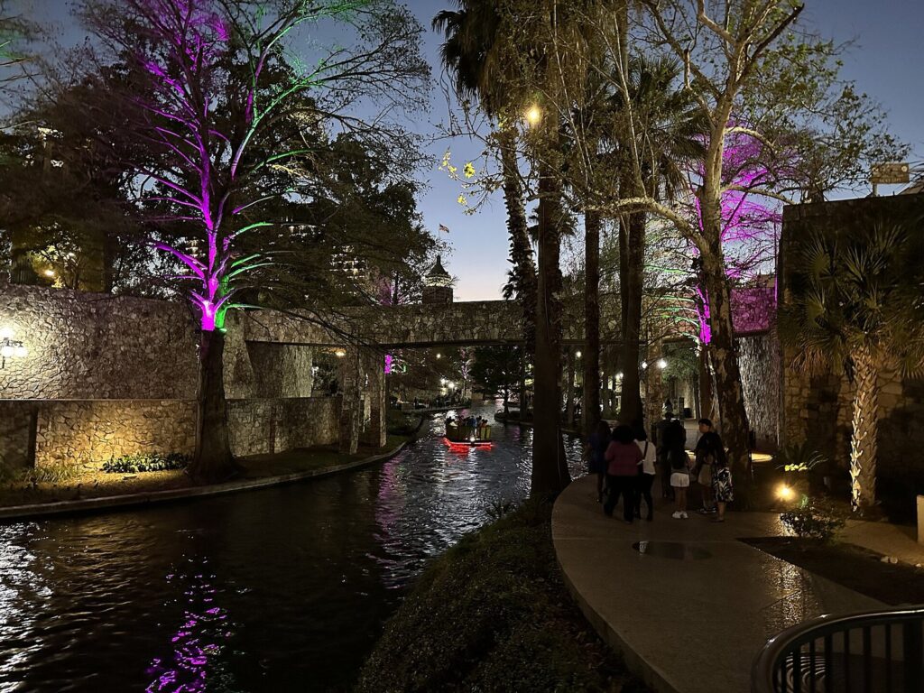
The loop is the River Walk at its most theatrical. Bald cypress trees and the buildings overhead keep much of it in shade, which is why it’s still pleasant on summer evenings while the streets above hold the day’s heat. It’s also narrow. On weekend nights the patio stretch gets crowded, much of the path has no railing at the water’s edge, and you’ll be stepping aside for boats and strollers. Hold small children’s hands, and don’t walk and text near the edge.
An hour covers the loop at a stroll, with a few bridge crossings and photo stops. Near the Hotel Contessa you’ll pass Marriage Island, a tiny island that couples book for weddings through the city’s parks department. Watch the water too: ducks work the channel, and yellow-crowned night herons hunt from the banks. The River Walk asks visitors not to feed wildlife people food, which harms the river.
Paseo del Alamo: the step-free link to Alamo Plaza
Paseo del Alamo, the passage between Alamo Plaza and the river, reopened on July 2, 2026 with a new Welcome Center and an elevator as part of the Alamo Plan work. It’s the easiest way down from the Alamo side for strollers and wheelchairs, and a sensible place for a group to regroup. The Alamo itself sits on the plaza above. It’s owned by the State of Texas and run by the Alamo Trust, and it deserves its own unhurried visit rather than a quick detour between dinner and a boat.
Plan it: free; the elevator connects river level with Alamo Plaza; the Alamo church is across the plaza at the top.
Arneson River Theatre and La Villita
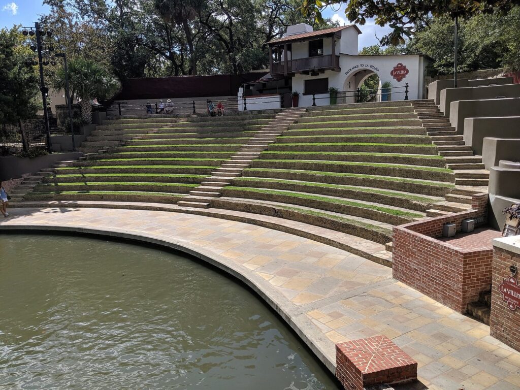
The Arneson River Theatre is one of the cleverest pieces of design on the river. The stage sits on one bank and the audience sits on grass-covered stone steps on the other, so boats glide between the show and the crowd. Above the seats is La Villita, a compact historic district now given over to shops and galleries. It’s free to wander, and it’s the most pleasant place to climb out of the loop toward Hemisfair.
Plan it: free to walk; La Villita’s shops generally open Monday to Saturday 10 a.m. to 6 p.m. and Sunday 11 a.m. to 4 p.m.; about 10 minutes on foot from Alamo Plaza (0.4 mile by street). DiwaliSA fills the theater and Hemisfair on Saturday, November 7, 2026, from 5 p.m. to midnight.
Hemisfair and the Tower of the Americas
Just past La Villita, Hemisfair occupies the grounds of the 1968 world’s fair, and it’s now a city park whose Civic Park section fully opened in March 2025. From March to October its splash pads run 9 a.m. to 9 p.m., and Yanaguana Garden is the best free stop downtown for kids who are done with walking. The Tower of the Americas rises 750 feet over the park, with an observation deck, a 4D ride called Skies Over Texas, the revolving Chart House restaurant and Bar 601. On a clear evening, the deck shows you the whole downtown bend at once. On a hazy afternoon, save your money.
Plan it: Hemisfair is free and open from 5 a.m. until at least 11 p.m. Tower of the Americas tickets cover the deck and the 4D ride: $19.50 for adults, $16 for seniors and military, $15 for ages 4 to 12, free for 3 and under. The tower opens 10 a.m. to 10 p.m. Sunday to Thursday and until 11 p.m. Friday and Saturday, and it has been cashless since February 2026. Renovation work was still under way in September 2026, so check its site before you go. It’s 16 minutes on foot from the Alamo.
Main Plaza and The Saga
A short walk west of the loop, Main Plaza faces San Fernando Cathedral. Every night except Monday at 9 p.m., the cathedral’s facade becomes the screen for The Saga, a 24-minute projection by artist Xavier de Richemont that covers about 7,000 square feet of stone with the city’s story. It costs nothing, it’s better than it sounds, and it’s one of the best free things to do in San Antonio after a riverside dinner.
Plan it: free; Tuesday to Sunday at 9 p.m., no Monday shows; 24 minutes; sit on the benches facing the cathedral; about 13 minutes on foot from the Alamo (0.6 mile).
South to King William and Blue Star
South of the loop, the river path runs past the King William Historic District, the neighborhood German immigrants settled and named for King Wilhelm I of Prussia. It became a city historic district in 1968 and joined the National Register in 1972. Keep going and you reach the Blue Star Arts Complex, where former ice and cold-storage warehouses now hold galleries and studios. This stretch is calmer and far less commercial than the loop, and on the first Friday of the month, the free art walk gives it a crowd.
Plan it: free; King William and Blue Star are each about 1.4 miles, or 31 minutes, from the Alamo on foot by street; First Friday starts at 6 p.m. at Blue Star, and the remaining 2026 dates are October 2, November 6 and December 4; the Guenther House restaurant and River Mill Store in King William open Wednesday to Sunday, 8 a.m. to 2 p.m.
How do you walk the Museum Reach to the Pearl?
From the loop, follow the river north. The City’s accessibility map calls this stretch the North Path, and it passes the Tobin Center for the Performing Arts before the Museum Reach proper begins at Lexington Avenue. From there it’s 1.3 miles to the Pearl, or 2.66 miles if you walk back the same way. Allow half a day if you plan to stop at a museum and eat at the Pearl, and from May to September, start by 8 a.m.
The Museum Reach opened on May 30, 2009, and it feels newer: fewer patios, more joggers, and longer views up the water than the loop’s tight bends allow. The San Antonio Museum of Art sits along it in the old Lone Star Brewery complex, built between 1895 and 1904, where the museum opened on March 1, 1981. It’s the natural place to spend the hottest hours of a summer morning, so check its hours and plan the walk around them.
The lock at Brooklyn Avenue
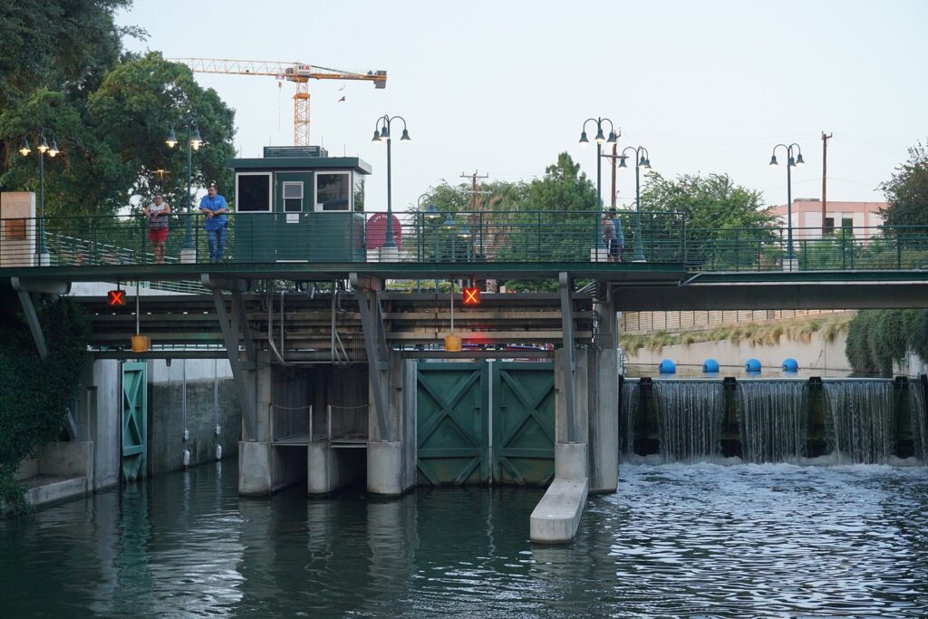
Boats can reach the Pearl because of the lock and dam at Brooklyn Avenue, which has two independent 40,000-gallon chambers and lifts barges about 9 feet. If a boat is locking through as you pass, stop and watch. It costs nothing, and grown adults line the rail for it as if it were a launch.
Art under the bridges
The Museum Reach doubles as an outdoor gallery. The best known piece is Donald Lipski’s F.I.S.H., a school of oversized fish hanging beneath the I-35 overpass. Look too for Carlos Cortés’s Grotto and Bill Fontana’s Sonic Passage, a sound installation. The path is lit after dark, and since the reach never closes, a short evening walk south from the Pearl is a good second look at the art in a cooler hour.
The Pearl
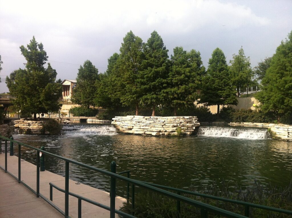
The Museum Reach ends at the Pearl, a former brewery where brewing began in 1883. It now holds restaurants, shops, Hotel Emma in the old brewhouse and a campus of the Culinary Institute of America. It’s the best place on the river to finish a walk: breakfast, cold drinks and a boat back downtown once the shuttle starts at noon.
Plan it: free to walk around; Saturday farmers market 9 a.m. to 1 p.m., rain or shine; Wednesday night markets 5 to 9 p.m. from September 16 to November 25, 2026; free Yoga Under the Stars on Thursdays at 7 p.m. through 2026. Surface lots are free Monday to Friday before 3 p.m., then $4 flat Monday to Thursday and $13 from 3 p.m. Friday and all weekend, with the first 30 minutes always free.
Past the Pearl: Brackenridge Park
The river keeps going north of the Pearl into Brackenridge Park, a large city park that holds the Japanese Tea Garden, the Sunken Garden Theater, the zoo and about 1.7 miles of walking trails. The Witte Museum sits beside the river at the park’s edge. It’s a separate outing, not an add-on to a Museum Reach walk in July.
Plan it: the park is free and open 5 a.m. to 11 p.m.; VIA Routes 9 and 14 serve the Witte and the park.
What’s the best way to see the Mission Reach?
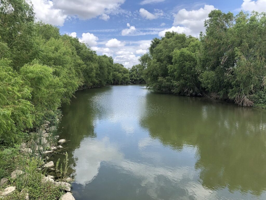
South of downtown, beyond Blue Star, the river becomes the Mission Reach, and the River Walk stops being an urban promenade. The banks open up, the channel bends through grass and brush, and the destinations are the four missions of San Antonio Missions National Historical Park: Concepción, San José, San Juan and Espada. With the Alamo, they make up the San Antonio Missions World Heritage Site, inscribed by UNESCO in 2015. All four churches are also active Catholic parishes, so dress and behave as you would at any working church, and expect a church to close to visitors during services.
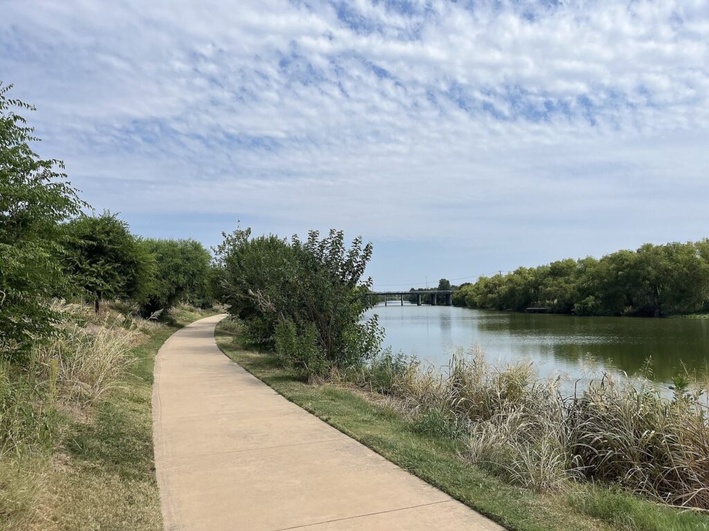
The trail is paved, and the park service counts about 10 miles of it linking the four missions and running north toward the Alamo. The catch is exposure. Long stretches have little shade, and on a summer afternoon the heat coming off the pavement is serious. Go early, carry more water than seems necessary, and remember that the Mission Reach closes at dusk and can flood. If you can’t see the path, don’t use it. The San Antonio River Authority, which manages this reach, also lists a paddling trail on it; check the authority’s site for launch points and river conditions.
| How to get between missions | What it involves | Verdict |
|---|---|---|
| E-bike share | San Antonio BCycle electric bikes; each trip includes 60 minutes of riding; stations at all four missions, Espada Dam and Confluence Park | The best option for most visitors from October to April |
| Car | Free parking at every mission; Concepción to Espada is about 15 minutes by road | The sensible choice in summer, with short walks at each stop |
| VIA bus | Route 42 reaches Concepción and San José only, about every 30 minutes; no bus goes to San Juan or Espada. The route had construction detours in 2026 and is realigned on January 11, 2027 | Fine for the two northern missions |
| On foot | Concepción is 2.9 miles, about an hour, from the Alamo by street; the park service puts Concepción and Espada about 6.5 miles apart | Only for serious walkers in cool weather |
Plan it: free, including the missions and their parking; the trail is open dawn to dusk; allow half a day by bike to see all four missions without rushing. Start at Mission San José’s visitor center, 6701 San José Drive, if you want maps and a ranger first. Free ranger programs include guided walks at San José at 10 and 11 a.m., with talks and demonstrations at the other missions, except on the first Wednesday of the month.
Espada Aqueduct and Dam
North of Mission Espada, the Espada Aqueduct carries an acequia, a colonial irrigation ditch, over Six-Mile Creek on two stone arches. Built between 1740 and 1745, it still carries water, and the park service calls it the oldest Spanish aqueduct in the United States. It’s the most striking stop on the reach and the obvious turnaround for a bike ride.
Plan it: free; parking at the aqueduct; a BCycle station at nearby Espada Dam; dawn to dusk.
Confluence Park
Confluence Park sits where San Pedro Creek meets the San Antonio River. The San Antonio River Foundation opened it in March 2018, and its concrete pavilions, shaped like petals, collect rainwater. It’s a good starting point if you want to ride south without first threading through downtown.
Plan it: free; 310 W. Mitchell Street; open sunrise to 11 p.m.; BCycle station on site.
Hot Wells
Hot Wells of Bexar County preserves the ruins of old sulfur-spring resorts beside the river. It became a county park in April 2019 and connects to the Mission Reach trails, which makes it an easy detour between San José and San Juan.
Plan it: 5503 S. Presa Street; open 9 a.m. to 9 p.m. in summer and 9 a.m. to 6 p.m. in winter.
Is a River Walk boat tour worth it?
On a first visit, yes, once. Go Rio River Cruises runs the boats, and its 35-minute narrated cruise is the quickest way to understand how the loop and its channels fit together. You also see the bridges from underneath, which is half the point. English tours run daily from 10 a.m. to 10 p.m. for most of the year, public cruises need no reservation, and you can buy tickets online or at the booths at Rivercenter (809 E. River Walk), Historia (706 River Walk) and Aztec (731 River Walk).
Two caveats. Go Rio’s online ticket page returned an error when we checked fares on September 23, 2026, so we couldn’t confirm current prices; recent adult fares have been under $20, and the booth will tell you the real number. And Go Rio gives no refunds, including for waits, so on a busy Saturday evening look at the line before you pay. A weekday morning ride is calmer.
| Narrated cruise | River shuttle | |
|---|---|---|
| What it is | A 35-minute narrated ride on the downtown river | Transport between downtown and the Pearl |
| When | Daily, 10 a.m. to 10 p.m. for most of the year | Daily, noon to 8 p.m., about every 60 minutes |
| Tickets | Per ride; under $20 for adults at recent prices | 1-day and 3-day passes |
| Verdict | Do it once, early in your trip | Handy for getting back from the Pearl; plan around the hourly gap |
When is the best time to visit the River Walk?
October, November, March and April are the easy months. Summer works if you follow the heat: river paths early, museums and air conditioning at midday, and the shaded loop after dark. The numbers below are NOAA’s 1991 to 2020 normals for the airport.
| Months | Average high | What it means on the river |
|---|---|---|
| January and February | 63 to 68°F | Cool and quiet; holiday lights into early January; bring a layer for an evening boat |
| March and April | 74 to 80°F | Prime walking weather on all three reaches; Fiesta runs April 15 to 25 in 2027 |
| May | 87°F | Warm, and the wettest month at 4.4 inches of rain on average |
| June to August | 92 to 96°F | Walk before 10 a.m. or after sunset; about 18 days a year reach 100°F, most of them in July and August |
| September | 90°F | Still hot, and the second-wettest month |
| October and November | 82 and 72°F | The best months for the Mission Reach; the holiday lights switch on in late November |
Time of day matters as much as the month. Before 10 a.m., all three reaches are quiet and cool enough for a long walk. Evenings on the loop are the River Walk at its most crowded and most atmospheric, with the trees lit and every patio full, and weekday evenings are calmer than Friday and Saturday.
Holiday lights, parades and Fiesta
The holiday lights come on with the 45th Ford Holiday River Parade on Friday, November 27, 2026, at 6 p.m., and then shine from sundown to sunrise into early January. The River Walk’s event page puts the count at about 200,000 lights. Go Rio also runs River North narrated tours only from December 19 to January 4, 6 to 9 p.m. In spring, Fiesta San Antonio (April 15 to 25, 2027) brings its river parade and the biggest crowds of the year. If you want the river quiet, avoid both.
Parking, transit and access
You don’t need a car for the downtown River Walk, and parking near it is the least enjoyable part of most visits. If you drive, the River Walk suggests setting your GPS to the Shops at Rivercenter, 849 E. Commerce Street.
Parking
- Street meters: there are more than 2,000 near the river. The River Walk’s FAQ says most are enforced 8 a.m. to 6 p.m. Monday to Saturday and are free outside those hours; read the meter before you walk away.
- City garages: free on Thursdays from 5 p.m. to 2 a.m. through the end of 2026. The City Tower Garage is free on Sundays, and St. Mary’s Garage is $5 after 5 p.m. on weeknights and all weekend.
- The Pearl: cheap or free on weekday mornings, $13 on weekend days (details above).
- The missions: free at all four.
Buses and the airport
VIA fares are $1.30 one way and $2.75 for a day pass, with free transfers. You can tap a Visa, Mastercard or Discover card or a phone wallet (not Amex), or use the goMobile+ or Transit app; day passes can’t be bought on board by card or wallet. Route 5 links the airport with downtown from the far west end of Terminal B, lower level, and has run every 30 minutes on weekdays since August 24, 2026. Route 42 reaches the two northern missions.
Stairs, ramps and elevators
The downtown River Walk was built in the late 1930s for strolling, not for wheelchairs, and it shows: many entrances from street bridges are stairs only. Since the early 1980s the City has added ramps and pathways and, with help from businesses, elevators at more than 50 locations. It publishes three ADA maps, River Bend, North Path and Museum Reach, that mark elevators, ramps, steps and stretches that aren’t wheelchair accessible. The maps are old (the North Path one is dated 2016), so call the City’s Disability Access Office at 210-207-7957 before you rely on a particular elevator.
Two step-free entries worth knowing are the Paseo del Alamo elevator, reopened in July 2026, and the Shops at Rivercenter, whose lower level opens onto the river. Tom’s Wheelchairs (210-223-7878) rents mobility equipment downtown. On the Mission Reach, the trail itself is paved.
How did the River Walk come to be?
Long before the River Walk, the river and its springs supported Coahuiltecan-speaking peoples. Spanish Franciscans founded missions along it in the 1700s, and the Indigenous people who lived in them dug the acequias that watered the fields. The Espada Aqueduct still carries water nearly three centuries later.
The modern San Antonio River Walk grew out of a disaster. On September 9, 1921, a cloudburst over the Olmos Basin sent a flood through downtown that put 9 feet of water on Houston Street and killed about 50 people. Olmos Dam was finished in 1927. On June 28, 1929, architect Robert H. H. Hugman presented Mayor Chambers with a plan he called “The Shops of Romula and Aragon,” a river lined with walkways and shops, and he has been called the Father of the River Walk ever since. Work began on October 25, 1939, when $75,000 in local money unlocked $325,000 from the Works Progress Administration.
The rest came in stages. The Paseo del Rio Association formed in 1964. HemisFair ’68 brought the river extension to the new convention center, and the Rivercenter extension opened in 1988. The Museum Reach followed on May 30, 2009, and the first mile of the Mission Reach opened in December 2010. Each addition was built for a different era and purpose, which is why the three reaches feel so different today.
San Antonio River Walk FAQ
Is the San Antonio River Walk free?
Yes. The River Walk is a public park, and walking any of its three reaches costs nothing, day or night. You pay for the extras: Go Rio boat rides, food and drinks, the Tower of the Americas and parking in most garages. The four missions along the Mission Reach charge no admission either, and their parking lots are free.
Is the River Walk open at night?
The Downtown and Museum reaches are open 24 hours, and both are lit after dark. The Mission Reach is open from dawn to dusk only. Restaurants, shops and boats keep their own hours, so very late at night you’ll find an open path and mostly closed doors. Go Rio’s narrated cruises run until 10 p.m. for most of the year.
Can you bring a dog on the River Walk?
Yes, on a leash. The River Walk welcomes leashed dogs, and many restaurant patios along it allow them, though it’s worth calling ahead about a specific place. Clean up after your dog and carry water. In summer, walk early or late, because stone and concrete paths heat up fast in the afternoon sun and can hurt paws.
Does the River Walk flood?
The downtown River Walk doesn’t, because a system of locks and dams controls the water through the center of the city. The Mission Reach can flood after heavy rain, and the River Walk’s advice is simple: if you can’t see the path, stay off it. May, September and October are the wettest months on average.
How do you get from the River Walk to the Alamo?
Use Paseo del Alamo, the passage that reopened on July 2, 2026 with a Welcome Center and an elevator linking the river to Alamo Plaza. The Alamo church is on the plaza at the top. By street, the Alamo is about 10 minutes on foot from La Villita and 13 from Main Plaza, so it’s easy to fold into a loop walk.
Is the River Walk worth visiting?
Yes, if you choose your reach and your hour. The downtown loop is commercial and crowded at peak times, and midday in July is the version to skip. The River Walk earns its reputation on the loop after dark, on a morning walk up the Museum Reach to the Pearl, and on the Mission Reach by bike in cool weather.
Related San Antonio Guides
- Things to Do in San Antonio: the city-wide shortlist, from the Alamo and the missions to the Pearl, the museums and the theme parks.
- Where to Stay in San Antonio: River Walk hotels versus the Pearl, King William and the theme-park resorts, with parking and noise compared.
Sources and How We Checked
This guide was checked on September 23, 2026 and is compiled from the operators and agencies listed below, not from other travel lists; it describes places from those sources and claims no first-hand visits.
- San Antonio River Walk (Paseo del Rio Association): FAQs, Our History, Maps, Museum Reach, Ford Holiday River Parade, Holiday Lights
- City of San Antonio: River Walk Maps and Accessibility, Museum Reach map (PDF), Affordable Parking, Hemisfair, Brackenridge Park
- National Park Service, San Antonio Missions: Directions, Basic Information, Fees, Espada Aqueduct
- San Antonio River Authority: Mission Reach
- Go Rio River Cruises: Narrated Tours, River Shuttles, Visitor Information, FAQ
- The Alamo: Alamo area construction news, July 2026
- Downtown attractions: Hemisfair, Tower of the Americas FAQ, Tower of the Americas entertainment, La Villita, Main Plaza: The Saga, DiwaliSA
- North of downtown: The Pearl history, About the Pearl, Pearl markets, Pearl parking, San Antonio Museum of Art history, Witte Museum
- South of downtown: King William Association, Blue Star Arts Complex, First Friday, Guenther House, San Antonio River Foundation: Confluence Park, Bexar County: Hot Wells, San Antonio BCycle stations
- Transit and events: VIA Route 42, VIA Metropolitan Transit, San Antonio International Airport, Fiesta San Antonio
- Weather: NOAA monthly normals, San Antonio airport, NOAA annual normals
- Walking and driving times: OpenStreetMap routing from Alamo Plaza
San Antonio Tourism Guide is an independent publication. We are not affiliated with Visit San Antonio, the City of San Antonio, the Alamo or any attraction listed here, and no one paid to be included.
Photo Credits
- River Walk footbridges at Rivercenter: photo by 3steph14, Wikimedia Commons (CC BY-SA 4.0)
- Downtown River Walk at night: photo by Mikael Häggström, Wikimedia Commons (CC0)
- Arneson River Theatre seating: photo by Eden, Janine and Jim from New York City, Wikimedia Commons (CC BY 2.0)
- Museum Reach lock and dam: photo by Michael Barera, Wikimedia Commons (CC BY-SA 4.0)
- Head of navigation on the Museum Reach: photo by Cohee, Wikimedia Commons (CC BY 3.0)
- Mission Reach of the San Antonio River: photo by Michaelluckey, Wikimedia Commons (CC BY 4.0)
- Mission Reach hike-and-bike trail: photo by Michaelluckey, Wikimedia Commons (CC BY 4.0)