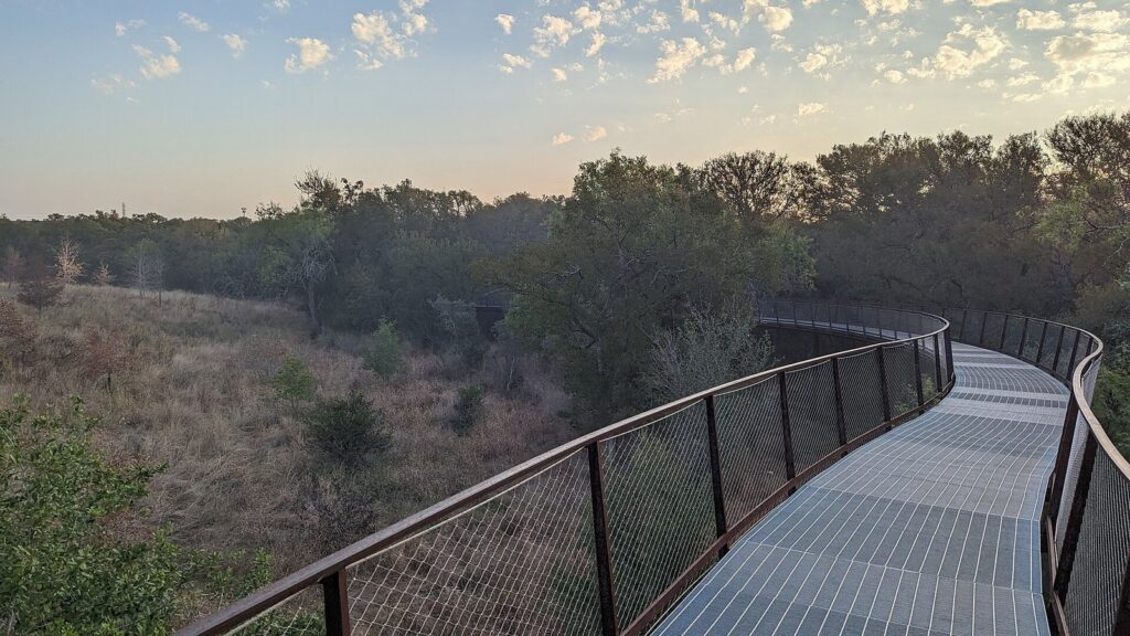
The best parks and outdoor activities in San Antonio are the Mission Reach, where you can walk, bike or paddle past four Spanish missions on a restored stretch of river; Government Canyon State Natural Area, with more than 40 miles of Hill Country trails and 104-million-year-old dinosaur tracks; Phil Hardberger Park and its wildlife land bridge; Brackenridge Park and the free Japanese Tea Garden in the middle of the city; Friedrich Wilderness Park for quiet, steep trails and rare birds; and the Howard W. Peak Greenway Trails, about 105 miles of multi-use paths along the creeks. For birders, Mitchell Lake on the South Side is the standout.
This guide is for visitors who want to get outside between museum and River Walk days, and for families who need somewhere to run. The constraint that shapes everything is heat: San Antonio averages highs of 92 to 96°F from June through August and sees about 18 days a year at 100°F or hotter, so outdoor plans belong before 11 a.m. from late spring to early fall. Most natural areas close at sunset, Government Canyon asks you to reserve a day pass, and several parks ban dogs or bikes. Rules, hours and fees were checked September 23, 2026 against Texas Parks and Wildlife, the City of San Antonio, the National Park Service and the parks themselves.
San Antonio Parks at a Glance
| Park | Best for | Trails | Cost (Sept. 2026) | Hours | Drive from the Alamo |
|---|---|---|---|---|---|
| Mission Reach Hike and Bike Trail | Biking, walking, the missions | About 10 miles connecting the four missions and the Alamo; paved | Free | Sunrise to sunset | 3 to 17 minutes to trailheads |
| Government Canyon State Natural Area | Real hiking, dinosaur tracks | More than 40 miles; easy to hard | $6 ages 13 and up | Gates from 7 a.m.; close 10 p.m. Friday to Monday, 8 p.m. Tuesday to Thursday | About 43 minutes |
| Friedrich Wilderness Park | Quiet, steep trails; birds | About 10 miles | Free | Sunrise to sunset | About 26 minutes |
| Eisenhower Park | North-side hiking | Natural-surface trails | Free | Sunrise to sunset | About 31 minutes |
| Phil Hardberger Park | The land bridge, easy walks | Paved and natural paths | Free | Sunrise to sunset | About 20 minutes |
| Brackenridge Park | Central green space, families | 1.7 miles of walking trails | Free | 5 a.m. to 11 p.m. | About 6 minutes; VIA 9 or 14 |
| Howard W. Peak Greenway Trails | Long walks and rides | About 105 miles in five systems | Free | Sunrise to sunset | Varies; 80-plus trailheads |
| Mitchell Lake Audubon Center | Birding, wetlands | Walking and driving trails | $5 adults | 7 a.m. to 3 p.m. in summer; 8 a.m. to 4 p.m. otherwise | About 19 minutes |
Drive times are free-flow estimates from Alamo Plaza using OpenStreetMap routing; add traffic and parking. For the full range of things to do beyond the parks, see our guide to things to do in San Antonio.
Where to Go Based on What You Want
| If you want | Go to | Why |
|---|---|---|
| A bike ride with history | Mission Reach Hike and Bike Trail | Paved, about 10 miles, four missions and BCycle stations at each |
| A proper hike | Government Canyon | More than 40 miles of trail, ridges and dinosaur tracks |
| Quiet trails without dogs or bikes | Friedrich Wilderness Park | Both are banned, so it stays peaceful |
| An easy walk with a point | Phil Hardberger Park | The wildlife land bridge over Wurzbach Parkway |
| Green space near downtown | Brackenridge Park | The Japanese Tea Garden, river and trails, 6 minutes’ drive |
| A paddle | Mission Reach Paddling Trail | An 8-mile official Texas Paddling Trail with 20-plus access points |
| Birds | Mitchell Lake Audubon Center | Wetlands and grasslands with walking and driving trails |
| A long run or ride | Howard W. Peak Greenway Trails | About 105 miles of multi-use trail along the creeks |
| Something for small children | Hemisfair, Brackenridge, Government Canyon’s Discovery Trail | Splash pads, playgrounds and short, easy trails |
How to Handle the Heat Outdoors
This isn’t a throwaway tip. NOAA’s 1991 to 2020 normals put San Antonio’s average high at 92.4°F in June, 94.9°F in July, 96.0°F in August and 90.1°F in September. Many of the trails on this page have long stretches with little shade, and the Mission Reach in particular is open to the sun.
- Start early. From May to September, be on the trail by 7 or 8 a.m. and off it by 11. Mitchell Lake shifts to 7 a.m. to 3 p.m. hours in summer for exactly this reason.
- Carry more water than you think. Don’t count on refills once you’re out on natural-area trails. The Mission Reach trail is the exception, with water fountains and restrooms along the way.
- Pick shaded trails in summer. The wooded trails at Friedrich, Eisenhower and Hardberger give more cover than the open Mission Reach.
- Save midday for water or indoors. Hemisfair’s splash pads run 9 a.m. to 9 p.m. from March to October, and a museum or a cave is the better choice at 2 p.m. in August.
- Know the evening options. Brackenridge Park stays open until 11 p.m., and the downtown River Walk is open 24 hours, so summer evening walks work well.
October to April is the season for longer hikes. A separate child guide will cover summer outdoor activities in more depth.
Best Hikes in San Antonio by Difficulty
| Difficulty | Trail | Length | What to know |
|---|---|---|---|
| Easy | Government Canyon Discovery Trail | 1.23 miles | Accessible nature trail near the visitor center, with a playscape |
| Easy | Brackenridge Park walking trails | 1.7 miles | Flat, central, near the Japanese Tea Garden |
| Easy | Mission San Juan’s Farm Loop and Yanaguana Trail | 0.2 and 0.25 miles | Short, with benches; links to the Mission Reach trail |
| Easy | Phil Hardberger Park and the land bridge | Choose your loop | Paved crossing over Wurzbach Parkway |
| Moderate | Mission Reach Hike and Bike Trail, one mission to the next | About 2 to 3 miles each way | Paved, out-and-back, little shade |
| Moderate | Friedrich Wilderness Park Main Loop | 1.68 miles | Steeper than it sounds; no dogs or bikes |
| Moderate | Friedrich Vista Loop | 0.82 miles | Short climb for views |
| Harder | Friedrich Restoration Way | 2.94 miles | The park’s longest trail |
| Harder | Government Canyon, Joe Johnston Route to the dinosaur tracks | About a five-mile hike | Rocky; no pets; check trail status after rain |
A separate child guide will rank more hikes by difficulty, shade and water.
The Mission Reach: Walk, Bike or Paddle Past the Missions
South of downtown, the San Antonio River Authority restored an 8-mile stretch of the river as the Mission Reach, a linear park with more than 16 miles of trail, a paddling trail and the Mission Portals artworks. The National Park Service’s Hike and Bike Trail, about 10 miles long, connects all four missions and extends north to the Alamo. It’s paved and out-and-back, not a loop, and it’s open from sunrise to sunset. Each mission is about two to three miles from the next, and there are water fountains and restrooms along the way.
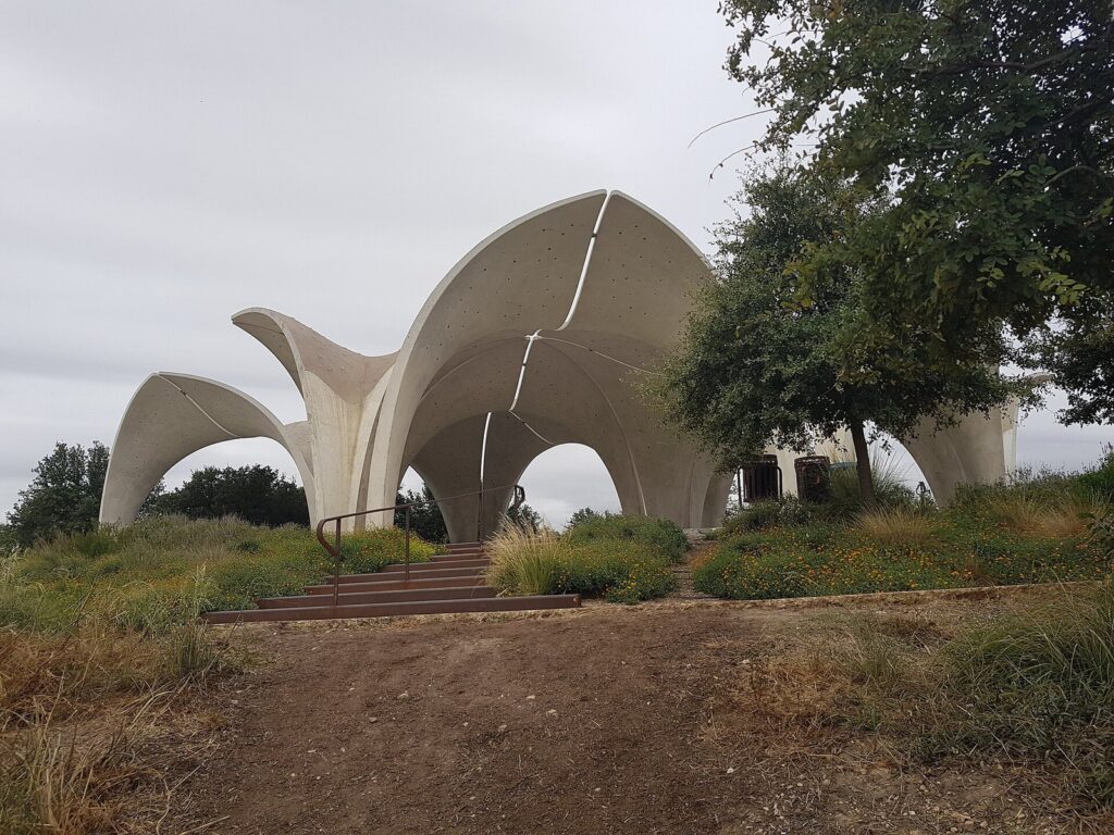
Two stops along the way are worth a detour. Confluence Park, the San Antonio River Foundation’s park at 310 W. Mitchell St., sits where San Pedro Creek meets the river; it opened in March 2018, and its concrete petal pavilions collect rainwater. It’s open from sunrise to 11 p.m. Further south, Hot Wells of Bexar County, at 5503 S. Presa St., preserves the ruins of sulfur-spring resorts as a county park that links to the Mission Reach trails; it’s open 9 a.m. to 9 p.m. in summer and 9 a.m. to 6 p.m. in winter.
Plan it: free, sunrise to sunset. BCycle has e-bike stations at all four missions, at Espada Dam and at Confluence Park; a $25 day pass covers unlimited one-hour trips, so you can dock at each mission and start a fresh hour. The missions are free, with free parking. One caution from the river’s managers: the Mission Reach can flood, so stay off it after heavy rain if the paths aren’t visible. Our San Antonio missions guide covers what to see at each stop.
Paddling the Mission Reach
The Mission Reach Paddling Trail, designated an official Texas Paddling Trail in 2017, runs about 8 miles from Roosevelt Park off Lone Star Boulevard to near Mission Espada. More than 20 access points, marked by blue poles, let you shorten the trip; some have steps to the water and others are natural paths. You’ll need to portage around Espada Dam. The full run takes about three to five hours depending on water levels and flow.
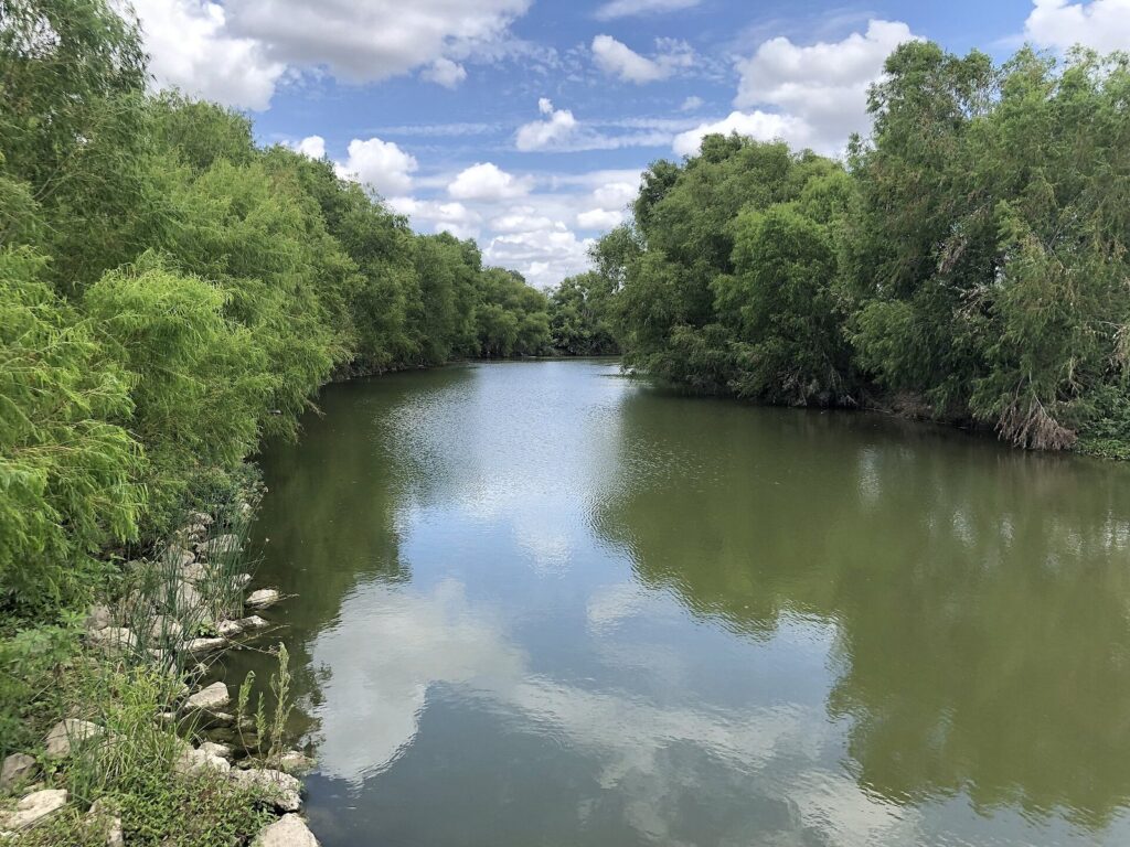
Plan it: bring your own boat or arrange a rental and shuttle ahead, check river flow before you go, and don’t paddle after heavy rain. In summer, launch at first light; the channel is open to the sun. A separate child guide covers kayaking the Mission Reach in detail.
Government Canyon State Natural Area
Government Canyon, on the far northwest edge of Bexar County, is the closest thing to real Hill Country hiking inside the county. It has more than 40 miles of trails through woods, grassland and up to limestone ridges with views across the Hill Country. The headline hike is the Joe Johnston Route, which passes a prehistoric midden and 104-million-year-old dinosaur tracks, thought to have been left by Acrocanthosaurus and Sauroposeidon, before reaching the 1880s Zizelmann House. They’re the only known dinosaur footprints on public land in Bexar County. For views, the Far Reaches Trail leads to the Chula Vista and Sotol overlooks.
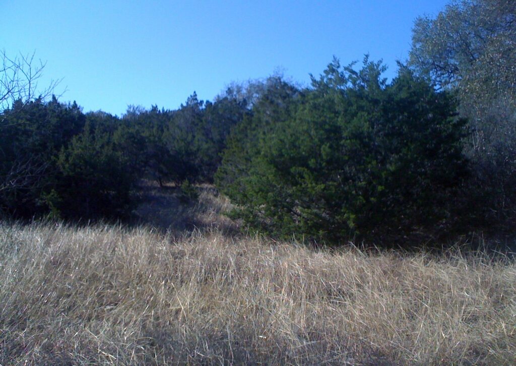
Families should start with the 1.23-mile Discovery Trail, an accessible nature trail near the visitor center, and the natural playscape. The Protected Habitat Area trails open only from September through February; all other trails are open year-round but close after rain or bad weather.
Plan it: about 26 miles and 43 minutes free-flow from the Alamo. Entry is $6 for ages 13 and up. Gates open daily at 7 a.m. and close at 10 p.m. Friday to Monday and 8 p.m. Tuesday to Thursday. Reserving a day pass is recommended to guarantee entry. Pets are allowed only on front-country trails, not on the dinosaur-track trail. The park closes on some dates in November, December and January for hunts; check before you drive. Bring plenty of water. A separate guide covers Government Canyon’s trails in detail.
Friedrich Wilderness Park
Friedrich is a City-run wilderness park on the far northwest side with about 10 miles of hiking trails. It’s known for rare birds, terrestrial orchids, steep hills and deep canyons, and it’s quieter than most city parks because dogs and bikes aren’t allowed. The Main Loop (1.68 miles) is the classic route; the Vista Loop (0.82 miles) is a short climb for views; and Restoration Way (2.94 miles) is the longest trail.
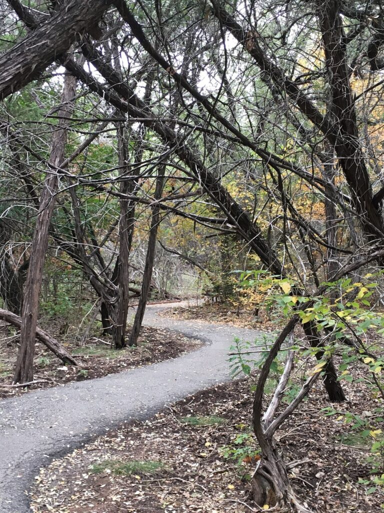
Plan it: free, sunrise to sunset. About 26 minutes’ drive from the Alamo. No pets, no bicycles. Download the City’s trail map before you go. A separate guide covers Friedrich’s trails one by one.
Eisenhower Park
Eisenhower Park, on the far north side, is another City natural area with wooded, natural-surface trails. It’s a good choice for a shaded morning hike when you don’t want the drive to Government Canyon.
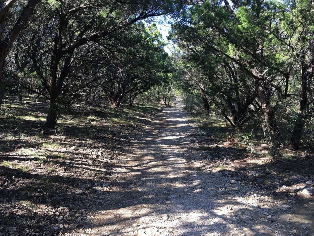
Plan it: free, sunrise to sunset. About 31 minutes’ drive from the Alamo. Get the City’s trail map before you go. A separate guide covers Eisenhower’s trails.
Phil Hardberger Park and the Land Bridge
Phil Hardberger Park, in north-central San Antonio, is split in two by Wurzbach Parkway, and the Robert L.B. Tobin Land Bridge joins the halves. The bridge is 150 feet wide, was finished on December 11, 2020 and is billed as the nation’s first mixed-use wildlife crossing: people use the Skywalk and the paths, and animals use the planted corridor. It’s an easy, interesting walk and a good introduction to the city’s native landscape.
Plan it: free, sunrise to sunset. About 20 minutes’ drive from the Alamo. Good for families and for anyone who wants an easy walk with a point. A separate guide covers the land bridge and the park’s trails.
Brackenridge Park and the Japanese Tea Garden
Brackenridge Park is the city’s great central park, a short drive or bus ride north of downtown. It holds a stretch of the San Antonio River, the Japanese Tea Garden, the Sunken Garden Theater, the San Antonio Zoo, Lambert Beach and 1.7 miles of walking trails, with the Witte Museum and the DoSeum as neighbors. The Japanese Tea Garden, terraced ponds and stone paths in a former quarry, is free and opens early. Jingu House, the cafe inside, is walk-in only.
The San Antonio Zoo sits inside the park at 3903 N. St. Mary’s St., open daily from about 9 a.m. to 5 p.m. depending on the season. Its ticket prices change by date; CityPASS quotes a box-office range of roughly $30 to $40 for adults.
Plan it: the park is open 5 a.m. to 11 p.m.; the Japanese Tea Garden 7 a.m. to 5 p.m. per the San Antonio Parks Foundation. Jingu House opens Monday to Thursday 10 a.m. to 4 p.m., Friday 10 to 5, and weekends 9 to 5. VIA Routes 9 and 14 serve the park. Picnic pavilions can be reserved through the park. A separate guide covers a walking itinerary through the park and the tea garden.
The Howard W. Peak Greenway Trails
San Antonio’s greenway system is the city’s best-kept outdoor secret for visitors: about 105 miles of multi-use, accessible trails along the creeks, with more than 80 main trailheads and around 1,700 acres of open space. It’s organized in five systems: Leon Creek, Medina River, Salado Creek, the Westside Creeks and other tributary trails. They’re open daily from sunrise to sunset, and neighborhood paths connect to the main trails.
Plan it: free. Download the City’s maps for the system you want and start from a trailhead with parking. The greenways are best for long walks, runs and rides rather than sightseeing. A separate child guide will pick the best greenway rides for visitors.
Three Half-Day Outdoor Plans
The missions by e-bike
- 7:30 a.m.: pick up a BCycle with a $25 day pass and ride south along the river toward Mission Concepción, stopping at Confluence Park on the way.
- 9 a.m.: dock at Concepción as the missions open, and look around while your next hour resets.
- 10 or 11 a.m.: ride on to Mission San José for a free ranger-guided walk and the park film.
- Noon: turn back if it’s hot, or continue to San Juan’s short Yanaguana Trail and on to Espada on a cool day.
Government Canyon at opening
- Before you go: reserve a day pass and check the trail status; trails close after rain.
- 7 a.m.: arrive as the gates open, about 43 minutes’ drive from downtown.
- 7:30 a.m.: hike the Joe Johnston Route to the dinosaur tracks, about a five-mile hike on rocky ground. With children, do the 1.23-mile Discovery Trail and the playscape instead.
- 11 a.m.: picnic, then head back to town before the midday heat.
The central parks loop
- 7 a.m.: walk Brackenridge Park’s trails along the river while it’s cool.
- 8 a.m.: the Japanese Tea Garden, which opens at 7 a.m., before the crowds.
- 10 a.m.: coffee at Jingu House inside the garden, then the Witte Museum or the zoo next door as the day heats up.
For more ways to fit outdoor time into a trip, see our San Antonio itineraries.
Birdwatching in San Antonio
Birders have more options here than you might expect in a city this size.
- Mitchell Lake Audubon Center: wetlands and grasslands on the South Side, with walking and driving trails. Adults pay $5; students, teachers, military and veterans $3; children under 5 free. Summer hours run from early June to early October, 7 a.m. to 3 p.m.; the rest of the year it’s 8 a.m. to 4 p.m. The gate closes an hour before closing time. Construction on bond-funded improvements is underway, so call ahead about trail access.
- Friedrich Wilderness Park: known for rare birds and quiet trails, with no dogs or bikes to flush them.
- Government Canyon: its Protected Habitat Area trails open only from September through February.
- Lost Maples, a day trip away: Texas Parks and Wildlife notes the endangered golden-cheeked warbler among its birds.
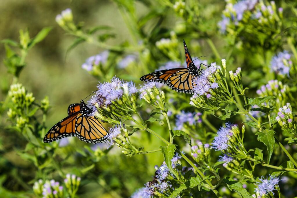
A separate child guide will map the best birding spots by season.
Green Spaces Downtown
You don’t need a car for a bit of green. Downtown’s parks are small but useful between sights:
- Hemisfair: the 1968 world’s fair grounds, now a free park with a fully open Civic Park and the Yanaguana Garden playground and splash pads.
- Travis Park: 2.6 acres open 5 a.m. to 11 p.m., with a dog park and public art.
- San Pedro Creek Culture Park: just over two miles of creekside paseos, with 12,793 linear feet of ADA-accessible paths and permanent public art.
- The River Walk: 15 miles in total, free, and the downtown and Museum Reach sections are open 24 hours. Our River Walk guide covers the reaches.
For a garden rather than a park, the San Antonio Botanical Garden charges $18 for adults Monday to Thursday and $22 Friday to Sunday, and from March to November it’s open 8 a.m. to 6 p.m. on weekdays and until 7 p.m. on weekends.
Best Parks for a Picnic
- Brackenridge Park: shade, river views and reservable pavilions, with the Japanese Tea Garden next door.
- Phil Hardberger Park: easy paths and space to spread out, plus the land bridge for a post-lunch walk.
- Government Canyon: picnicking is allowed, and the Discovery Trail makes an easy walk afterward.
- Confluence Park: shade under the concrete petals near the start of the Mission Reach.
- Hemisfair: downtown, with playgrounds for children.
A separate child guide will rank picnic parks by shade, restrooms and parking.
San Antonio Outdoors by Season
| Season | Typical weather | Best outdoor plans |
|---|---|---|
| Spring (March to May) | Average highs from about 74°F in March to 87°F in May | Long hikes at Government Canyon and Friedrich; the whole Mission Reach by bike; wildflowers along the trails |
| Summer (June to August) | Average highs of 92 to 96°F | Dawn rides and paddles, splash pads, Mitchell Lake’s early hours, evening River Walk strolls |
| Fall (September to November) | About 90°F in September, easing to 72°F by November | Government Canyon’s Protected Habitat Area reopens in September; hiking weather returns in October |
| Winter (December to February) | Highs in the 60s, lows around 41 to 45°F | The best hiking season; check Government Canyon’s hunt-closure dates |
Figures are NOAA’s 1991 to 2020 normals for San Antonio. Rain can close natural-surface trails at any time of year, so check trail status after storms.
What to Bring
- Water: at least a liter per person for a short hike, more in summer and on longer trails.
- Sun protection: a hat and sunscreen, even on wooded trails, which open up in places.
- Proper shoes: Government Canyon’s routes are rocky, and Friedrich’s climbs are steep.
- Offline maps: download the City or state park trail maps before you go.
- Your reservation: Government Canyon day passes are dated; bring the confirmation.
- A plan for the dog: leave it at home for Friedrich and the dinosaur-track trail.
Outdoors With Kids
The easiest outdoor wins with children are Yanaguana Garden at Hemisfair, with splash pads from March to October; Brackenridge Park, where the zoo, the Witte, the DoSeum and the Kiddie Park are all nearby; and Government Canyon’s Discovery Trail and playscape. Children 12 and under enter Texas state parks free, though Government Canyon charges from age 13. For water days in summer, Morgan’s Inspiration Island, the accessible water park, runs from May to mid-September with free waterproof wheelchairs. Our guide to San Antonio with kids covers the rest.
Accessibility on San Antonio’s Trails
Several of the best options work with a wheelchair or stroller. The City describes the greenway trails as multi-use and accessible and publishes trail accessibility maps. Government Canyon’s 1.23-mile Discovery Trail is built as an accessible nature trail. The Mission Reach Hike and Bike Trail is paved, and Mission San Juan’s short Yanaguana Trail has benches. San Pedro Creek Culture Park was built with ADA-accessible paseos. Watch for exceptions: at Espada Dam, the path slopes downhill at more than 14% with no benches, and the Park Service suggests visitors with mobility concerns stay in their vehicles there, though the nearby Espada Aqueduct viewing area is nearly level.
Getting to the Trailheads
Only some of these parks work without a car. Brackenridge Park is on VIA Routes 9 and 14, and the Mission Reach is easy by bike from downtown or on VIA Route 42, which serves Concepción and San José about every 30 minutes; no bus reaches San Juan or Espada. Everything else on the edges of the city needs a car or a rideshare: Hardberger Park and Mitchell Lake are each about 20 minutes’ drive from the Alamo, Friedrich about 26 minutes, Eisenhower about 31 and Government Canyon about 43 in free-flowing traffic. Parking is free at the missions, and the natural areas have their own lots at the trailheads. If you’re renting a car for a single day, pair a morning hike with a Hill Country drive or a theme park afternoon.
Rules Worth Knowing Before You Go
- Hours: most natural areas and greenways close at sunset; Brackenridge Park stays open until 11 p.m.
- Reservations: Government Canyon recommends reserving day passes; state parks sell dated passes online.
- Dogs: not allowed at Friedrich, and only on front-country trails at Government Canyon.
- Bikes: not allowed at Friedrich; the Mission Reach and greenways are built for them.
- Weather closures: trails at Government Canyon close in poor conditions, and the Mission Reach can flood.
- Hunt closures: Government Canyon closes on some dates from November to January.
For getting to trailheads by bus, bike or car, see our guide to getting around San Antonio. For bigger outdoor days, including Enchanted Rock, Guadalupe River State Park and Lost Maples, see our day trips from San Antonio.
San Antonio Parks and Outdoors FAQ
Where can you see dinosaur tracks near San Antonio?
At Government Canyon State Natural Area on the city’s northwest edge. The Joe Johnston Route leads to 104-million-year-old tracks, the only known dinosaur footprints on public land in Bexar County, on roughly a five-mile hike over rocky ground. Pets aren’t allowed on that trail, entry is $6 for ages 13 and up, and trails close after heavy rain.
What’s the best bike ride in San Antonio for visitors?
The Mission Reach Hike and Bike Trail. It’s paved, about 10 miles long, links all four missions and extends north to the Alamo. BCycle’s $25 day pass covers unlimited one-hour e-bike trips, with stations at every mission, so you can stop and look around without paying overtime. Start early in summer; there’s little shade.
Can you kayak in San Antonio?
Yes, on the Mission Reach Paddling Trail, an official Texas Paddling Trail of about 8 miles from Roosevelt Park to near Mission Espada. More than 20 access points let you shorten it, and you’ll portage around Espada Dam. The full trip takes three to five hours depending on flow. Check water levels first and stay off the river after heavy rain.
Which San Antonio parks allow dogs?
Many city parks do, including Travis Park downtown, which has a dog park. Rules vary by site: Friedrich Wilderness Park bans pets entirely, and Government Canyon allows them only on front-country trails, not on the dinosaur-track route. The downtown River Walk also allows leashed dogs. Check each park’s rules before you go.
Is it too hot to hike in San Antonio in summer?
Not if you go early. Average highs run 92 to 96°F from June through August, so start by 7 or 8 a.m., pick wooded trails like Friedrich or Eisenhower, carry plenty of water and finish by late morning. Save the long, exposed hikes and the Mission Reach for October through April.
What’s the best free park in San Antonio?
For most visitors, Brackenridge Park with the free Japanese Tea Garden, open from early morning and a short bus ride from downtown. For hikers, Friedrich Wilderness Park is free and far quieter. For something unusual, walk the wildlife land bridge at Phil Hardberger Park, also free.
Are San Antonio’s parks free?
Almost all of the city’s parks are. Brackenridge Park, the Japanese Tea Garden, Phil Hardberger Park, Friedrich and Eisenhower, the greenway trails, the Mission Reach and the missions themselves charge nothing. The exceptions are Government Canyon State Natural Area ($6 for ages 13 and up), Mitchell Lake Audubon Center ($5 for adults) and the San Antonio Botanical Garden ($18 to $22 for adults).
Related San Antonio Guides
- San Antonio Missions: the four missions along the Mission Reach.
- Day Trips from San Antonio: Enchanted Rock, Lost Maples and Hill Country rivers.
- San Antonio With Kids: playgrounds, splash pads and family days.
- San Antonio on a Budget: free parks and cheap outdoor days.
- Getting Around San Antonio: BCycle, VIA and driving to trailheads.
Sources and How We Checked
Hours, fees, trail lengths and rules in this guide were checked on September 23, 2026. The guide is compiled from the agencies and park operators listed below rather than from other travel lists, and it does not claim first-hand visits; drive times come from OpenStreetMap routing from Alamo Plaza.
- Texas Parks and Wildlife Department: Government Canyon State Natural Area, Mission Reach Paddling Trail, Lost Maples
- City of San Antonio: Howard W. Peak Greenway Trails, Friedrich Wilderness Park, Eisenhower Park, trail accessibility maps, Brackenridge and Travis parks
- National Park Service: San Antonio Missions National Historical Park, trails and accessibility
- San Antonio River Authority: Mission Reach; San Antonio River Foundation: Confluence Park; San Antonio River Walk: hours and flood guidance
- Phil Hardberger Park Conservancy: land bridge; Brackenridge Park Conservancy: things to do; San Antonio Parks Foundation: Japanese Tea Garden
- Mitchell Lake Audubon Center: plan your visit; Bexar County: Hot Wells; San Antonio Botanical Garden: admission
- San Antonio BCycle: passes and stations; Hemisfair: park information; Morgan’s Wonderland: Inspiration Island
- NOAA National Centers for Environmental Information: 1991 to 2020 climate normals
San Antonio Tourism Guide is an independent publication. We are not affiliated with Visit San Antonio, the City of San Antonio, the Alamo or any attraction listed here, and no one paid to be included.
Photo Credits
- Tobin Land Bridge Skywalk, Phil Hardberger Park: photo by TeresaShumaker, Wikimedia Commons (CC0)
- Confluence Park: photo by Irid Escent, Wikimedia Commons (CC BY-SA 2.0)
- San Antonio River on the Mission Reach: photo by Michaelluckey, Wikimedia Commons (CC BY 4.0)
- Government Canyon State Natural Area: photo by Zereshk, Wikimedia Commons (Public domain)
- Friedrich Wilderness Park trail: photo by Biotrope, Wikimedia Commons (CC BY-SA 4.0)
- Eisenhower Park trail: photo by Biotrope, Wikimedia Commons (CC BY-SA 4.0)
- Monarchs at Mitchell Lake Audubon Center: photo by cricketsblog, Wikimedia Commons (CC BY 2.0)