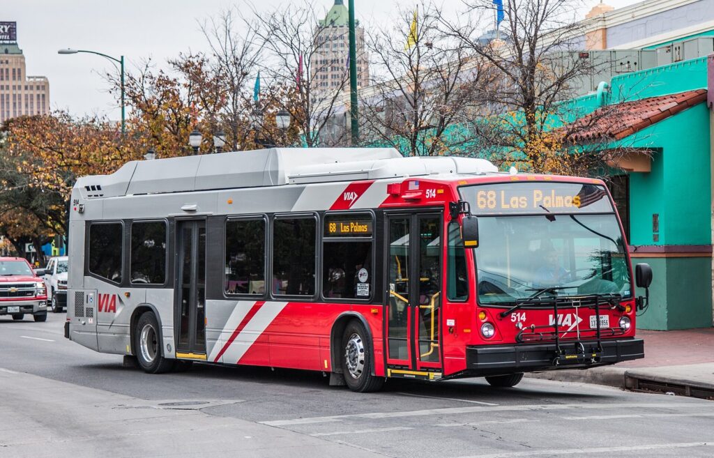
The short answer to how to get around San Antonio: walk the downtown core, where the Alamo, the River Walk, La Villita, Hemisfair and Market Square all sit within about a mile of each other, then use a rideshare, a VIA bus or a BCycle e-bike for the places just beyond it, and rent a car only if your plans include the theme parks, the Hill Country or several stops outside Loop 410. Most first-time visitors who stay downtown can skip the rental entirely. Most who stay out by the theme parks or the northwest resorts can’t.
This guide is for travelers deciding how to move around before they book, and for anyone already in town trying to work out whether the Pearl is walkable or the missions are bikeable. The caveat that shapes every answer is heat: from June through August the average high runs 92 to 96°F, so a 30-minute walk that’s pleasant in March is a slog in July. Fares, routes, parking rates and rules below were checked September 23, 2026 against VIA Metropolitan Transit, San Antonio International Airport, San Antonio BCycle, the City of San Antonio, the Alamo and the National Park Service. They change, so the date matters.
San Antonio Transportation at a Glance
| Option | Typical cost (Sept. 2026) | Best for | Time outdoors | Book ahead? |
|---|---|---|---|---|
| Walking | Free | The Alamo, River Walk, La Villita, Hemisfair, Main Plaza, Market Square | High; walk mornings and evenings in summer | No |
| VIA bus | $1.30 a ride, $2.75 day pass | Airport (Route 5), Brackenridge Park and the Witte, the two closest missions | Waits at stops, many unshaded | No; load the Transit or goMobile+ app |
| Go Rio river shuttle | Sold as 1-day and 3-day passes | Downtown to the Pearl on the water, noon to 8 p.m. | Moderate; open boats | No |
| BCycle e-bike | $15 for one hour, $25 for a day pass | The Mission Reach trail, the Museum Reach, short hops between stations | High | No; buy in the app |
| Rideshare or taxi | Airport taxi $24 to $29 to downtown areas; rideshare varies with demand | Evenings, the theme parks, anywhere off the bus network | Low | No |
| Rental car | Daily rate plus parking; city lots $2 to $10 a day | Theme parks, caverns, Hill Country towns, day trips | Low | Yes, reserve with your flight |
| Rental scooter | Per-minute pricing in the app | Short street hops downtown | High | No |
The pattern that works for most visitors: walk the downtown days, ride to the one or two stops beyond reach, and rent a car for a single day if you’re driving out of town. The full list of what’s worth your time is in our guide to things to do in San Antonio; this page is about getting between them without wasting half the trip in traffic or in the sun.
Do You Need a Car in San Antonio?
It depends almost entirely on where you sleep and where you’re headed. San Antonio is a big, spread-out city of freeways and loops, but the part most visitors come for is compact. The Alamo to the far end of Market Square is under a mile. The Pearl is a mile and a half up the river. Past that, distances open up fast: SeaWorld is 18 miles from Alamo Plaza, Six Flags Fiesta Texas 16, Natural Bridge Caverns 27. A car downtown is mostly a parking bill. A car without one on the northwest side is a problem.
| Your trip | Car? | Why |
|---|---|---|
| Downtown weekend: Alamo, River Walk, La Villita, Market Square, the Pearl | No | Everything is walkable or a short ride; parking and valet fees add up with nothing to show for them |
| Downtown plus the four missions | Probably not | Bike the Mission Reach on BCycle or use rideshare; VIA Route 42 reaches Concepción and San José only |
| One theme park day | Not necessarily | A rideshare each way can cost less than a rental plus Six Flags parking, which starts at $39 online |
| Two or more theme park or cavern days | Yes | Round-trip rideshares to parks 16 to 27 miles out get expensive quickly |
| Hill Country day trips | Yes | No practical transit reaches Fredericksburg, Gruene, Boerne or Bandera |
| Staying near La Cantera, the Rim or a northwest resort | Yes | Downtown is 25 to 30 minutes away in light traffic, and walking there isn’t an option |
| Family with small children staying downtown | For one day at most | Rent for the park or zoo day, not the whole week |
The middle path beats either extreme. Arrive by rideshare or Route 5, spend the downtown days on foot, then rent a car for one day at the airport, where the Alamo, Enterprise and National counters are open 24 hours. You pay one day’s rental and one night’s parking instead of five. Our guide to where to stay in San Antonio covers the neighborhoods, and the choice of hotel makes this decision for you more than anything else here.
Rideshare versus rental comes down to a count of trips. If you can list the drives you’ll make outside downtown and there are fewer than three, rideshare usually wins once you add parking, fuel and the hassle of downtown garages. If the list runs to four or five, or includes anything past Loop 1604, rent.
How Far Apart Are San Antonio’s Main Sights?
Walking figures are street routes from Alamo Plaza; drive figures are free-flow times from the same spot, so add traffic, a garage and the walk from the garage. Both come from OpenStreetMap routing run on September 23, 2026.
| Destination | Walk from the Alamo | Drive (free-flow) | Best way there |
|---|---|---|---|
| La Villita | 0.4 mi, 10 min | Not worth it | Walk |
| Main Plaza and San Fernando Cathedral | 0.6 mi, 13 min | 0.8 mi, 2 min | Walk |
| Yanaguana Garden at Hemisfair | 0.6 mi, 12 min | Not worth it | Walk |
| Spanish Governor’s Palace | 0.7 mi, 15 min | Not worth it | Walk |
| Tower of the Americas | 0.7 mi, 16 min | 1.0 mi, 3 min | Walk |
| Historic Market Square | 0.9 mi, 19 min | 1.4 mi, 4 min | Walk, or a short ride in summer |
| San Antonio Museum of Art | 1.0 mi, 22 min | Short hop | Walk the Museum Reach |
| King William and Blue Star | 1.4 mi, 31 min | 1.6 mi, 4 min | Walk the river south, or BCycle |
| The Pearl | 1.5 mi, 33 min | 1.8 mi, 4 min | River walk north, river shuttle, BCycle or rideshare |
| The DoSeum | 2.1 mi, 46 min | Short hop | Rideshare |
| Mission Concepción | 2.9 mi, 61 min | 3.3 mi, 7 min | BCycle, VIA 42 or rideshare |
| Witte Museum and Japanese Tea Garden | Too far | 3.1 to 3.2 mi, 6 min | VIA 9 or 14, or rideshare |
| San Antonio Zoo | Too far | 3.6 mi, 8 min | VIA or rideshare |
| McNay Art Museum | Too far | 4.7 mi, 9 min | Rideshare or car |
| Mission San José | Too far | 5.9 mi, 11 min | BCycle, VIA 42 or car |
| Mission San Juan | Too far | 7.6 mi, 14 min | Bike or car; no bus |
| Mission Espada | Too far | 11.8 mi, 17 min | Bike or car; no bus |
| San Antonio International Airport | Too far | 12.0 mi, 22 min | VIA Route 5, rideshare or taxi |
| Morgan’s Wonderland | Too far | 11.8 mi, 19 min | Car or rideshare |
| Six Flags Fiesta Texas | Too far | 16.4 mi, 27 min | Car or rideshare |
| SeaWorld San Antonio | Too far | 18.4 mi, 30 min | Car or rideshare |
| Natural Bridge Caverns | Too far | 27.4 mi, 37 min | Car |
Two things jump out. The 15-minute radius around the Alamo covers most of a first-day list, so the core really is a walking city. And the missions are not “just outside downtown” in any practical sense: Concepción, the closest, is an hour’s walk along roads with little shade. Plan them as their own half-day, with a bike, a bus or a car.
Getting From the Airport to Downtown
San Antonio International Airport (SAT) sits just north of Loop 410, about 12 miles by road from Alamo Plaza and 22 minutes in free-flowing traffic. You have four realistic options, and which one wins depends on your budget, your luggage and whether you’ll need a car later anyway.
| Option | Cost (Sept. 2026) | Where to find it | Verdict |
|---|---|---|---|
| VIA Route 5 | $1.30 | Far west end of Terminal B, lower level | Cheapest by a mile; about 30 minutes to downtown, every 30 minutes on weekdays |
| Rideshare (Uber, Lyft and other approved apps) | Varies with demand | Outer commercial curbside, lower level of Terminal A | Easiest door-to-door choice for most travelers |
| Taxi | $24 to $29 to downtown areas | Outer commercial curbside at Terminal A | Good value for groups; up to six riders if the luggage fits |
| Rental car | Daily rate plus hotel or garage parking | Consolidated Car Rental Facility, via Terminal B’s mezzanine and the Sky Bridge | Only if you’ll drive out of town in the next day or two |
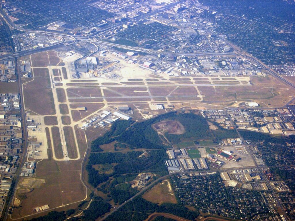
VIA Route 5 from the airport
Route 5 (McCullough) connects the airport and downtown every day, and since the August 24, 2026 service changes it runs every 30 minutes on weekdays. The ride takes about half an hour. The stop is at the far west end of Terminal B on the lower level, which is a walk if you land at Terminal A, so give yourself a few minutes. Pay with the goMobile+ or Transit app, a goCard, cash, or by tapping a Visa, Mastercard or Discover card or a phone wallet at the farebox. American Express isn’t accepted. If you want a $2.75 day pass rather than a $1.30 single fare, buy it in the app before you board, because day passes can’t be bought on the bus by card or phone.
Check the weekend timetable in the app before counting on a 30-minute gap on a Saturday, and skip the bus if you’re wrangling two big suitcases and a stroller. That’s what the taxi line is for.
Rideshare and taxi pickups
Both rideshare and taxis load at the outer commercial curbside at Terminal A, even if your flight came into Terminal B. Approved rideshare companies at SAT include Uber, Lyft, Wingz and Wridz. The airport quotes taxi fares to downtown areas starting at $24 to $29 per cab, and lists the metered rates behind them: a $3.50 initial drop, $2.70 per mile after the first mile, 40 cents per minute of waiting, a $1.25 airport departure fee, a $20 minimum on airport departures and a $1 night surcharge from 9 p.m. to 5 a.m. A taxi for four with bags often costs about what a rideshare does at a busy hour, without the surge pricing roulette.
Picking up a rental car
Rental counters are in the Consolidated Car Rental Facility: take the elevator or escalator to the Mezzanine Level in Terminal B and cross the Sky Bridge. The drive downtown is mostly US 281 south, slower at rush hour than the free-flow number suggests.
Is Downtown San Antonio Walkable?
Yes, with two footnotes: the heat and the stairs. The historic core grew up around the river and the old plazas rather than on a clean grid, so streets bend, change names and dead-end at the water. That’s annoying in a car and pleasant on foot. The main sights sit close together, and the River Walk gives you a second, lower route that avoids traffic altogether.
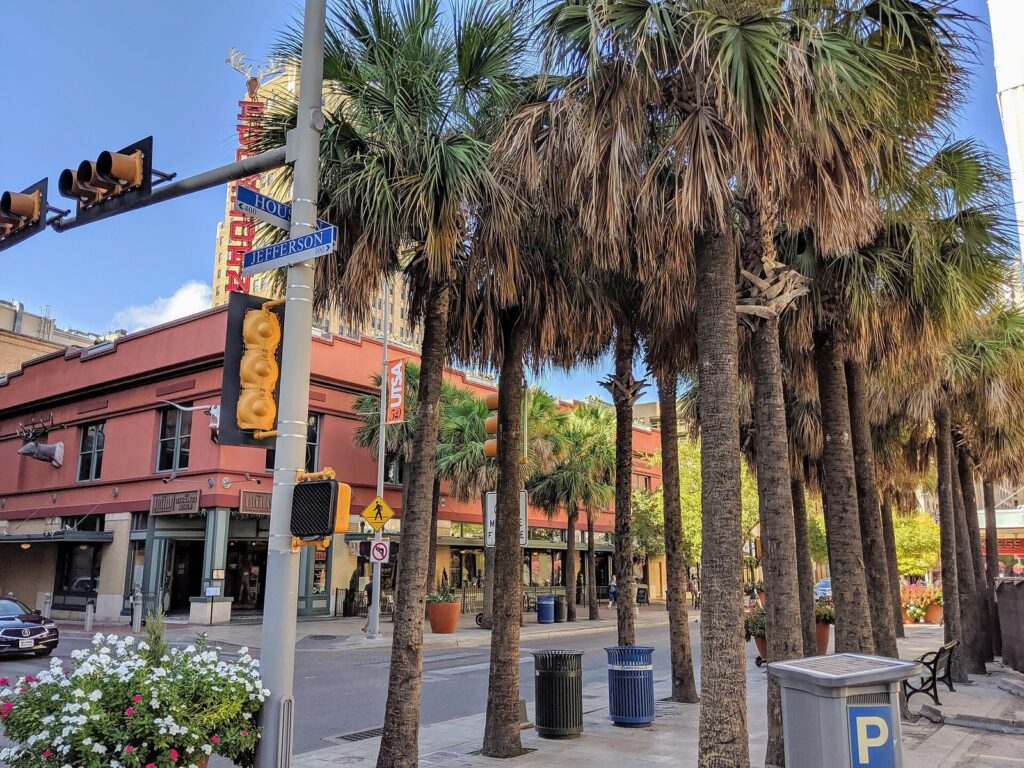
Street level versus the River Walk
The River Walk sits below street level and follows the river’s loops, so it’s often longer than the street route above. Use the street to get somewhere and the river when the walk is the point. The downtown and Museum Reach sections are open 24 hours; the Mission Reach, south of downtown, is open dawn to dusk only. Some downtown access points are stairs only, and the City publishes River Walk accessibility maps that mark the ramps and elevators. Our River Walk guide covers the reaches, the boats and the access points in depth.
Around the Alamo right now
Construction under the Alamo Plan is reshaping the blocks around the church, and it changes how you walk the area. As of September 2026, Alamo Plaza is closed to vehicles. Paseo del Alamo, the passage linking Alamo Plaza and the River Walk, reopened July 2, 2026 with a new Welcome Center and an elevator, which makes it the easiest step-free way between the plaza and the river. Houston Street is fenced along the museum build, with the north sidewalk between Losoya and Alamo streets open to pedestrians. Street work there is due to start in January 2027, after which that block becomes pedestrian-only. The Alamo provides no parking of its own. Our complete Alamo visitor guide tracks the construction and the free timed tickets for the church.
Walking to the Pearl and Southtown
Both are within reach outside the hottest months. The Pearl is 1.5 miles, about 33 minutes, from Alamo Plaza by street, but the better route is the Museum Reach, which passes the San Antonio Museum of Art and runs under I-35, where Donald Lipski’s school of lit fish, F.I.S.H., hangs from the overpass. King William and the Blue Star Arts Complex are 1.4 miles south, about 31 minutes, and the river path heading that way is quieter than the tourist loop. In July, do either walk before 10 a.m. or after sunset, or take one leg by bike or rideshare.
San Pedro Creek, the other walking corridor
West of the main downtown loop, San Pedro Creek Culture Park runs just over two miles through downtown, with 12,793 linear feet of ADA-accessible paseos and permanent public art. It connects neatly toward Market Square and the west side of downtown, and it’s far less crowded than the River Walk.
How to Ride VIA Buses as a Visitor
VIA Metropolitan Transit runs the city’s buses: 75 routes, including three limited-stop Primo routes and four express routes. For visitors it isn’t a sightseeing network, but it handles a handful of specific trips well, and it’s cheap.
Fares and how to pay
- Single ride: $1.30, with free transfers. Express routes are $2.60.
- Day pass: $2.75. Buy it in the goMobile+ or Transit app, or with a goCard; you can’t buy a day pass on board by card or phone.
- Longer passes: $12 for seven days and $38 for 31 days, which only matter for long stays.
- Tap to pay: Visa, Mastercard, Discover and phone wallets work at the farebox. American Express doesn’t.
- Cash: accepted on board, though an app ticket saves fumbling for change.
The routes visitors actually use
| Where you’re going | Route | What to know |
|---|---|---|
| Airport to and from downtown | 5 | About 30 minutes; every 30 minutes on weekdays |
| Witte Museum, Brackenridge Park and the Japanese Tea Garden area | 9 or 14 | The Witte names both routes on its own directions |
| Missions Concepción and San José | 42 | About every 30 minutes; construction detours posted in 2026; route realigns January 11, 2027 |
| Missions San Juan and Espada | None | No bus reaches them; bike the Mission Reach or drive |
| Late evenings from downtown | Late Night Service | Buses leave various downtown locations at 10:30 p.m., 11:30 p.m. and 12:30 a.m. |
| Early or late through downtown | Primo 100 | Runs 4 a.m. to 1 a.m. daily |
What changed in 2026, and what’s coming
VIA’s Better Bus Plan changes took effect on August 24, 2026, with more direct routes and expanded VIA Link zones, where app-booked on-demand vans cover neighborhoods buses serve poorly. Any route map older than that date may be wrong, so plan in the Transit app, which shows live arrivals. Construction is also underway on the VIA Rapid Green Line, a rapid-transit route that will link the airport, downtown and Brooks along San Pedro Avenue. VIA has said it expects the line to open in 2028. Until then, expect stop closures and detours along the corridor.
Is the bus worth it?
For Route 5 from the airport, the Witte and Brackenridge Park, or Concepción and San José, yes. For hopping between downtown sights, no: you’ll walk faster than you’ll wait. The honest drawback in summer is the stop itself. Many stops outside downtown have little shade, and a 20-minute wait at 3 p.m. in August is a poor trade for saving a few dollars on a rideshare. Ride in the morning, and check the live arrival before you leave. And don’t look for a streetcar: older guides mention one, but VIA runs none.
The Go Rio River Shuttle: Transport or Tour?
Go Rio runs a river shuttle alongside its narrated cruises. It operates daily from noon to 8 p.m., roughly every 60 minutes, between downtown and the Pearl, and you ride it on 1-day or 3-day passes. Tickets are sold at booths at Rivercenter (809 E. River Walk), Historia (706 River Walk) and Aztec (731 River Walk), or online. Check current pass prices on Go Rio’s own site before you go, because we couldn’t confirm them at the time of this update.
Treat it as a scenic way to make one trip, not as transit. An hourly boat that starts at noon won’t keep a schedule for you, but gliding up the Museum Reach to the Pearl for lunch beats a 33-minute walk in the heat.
Biking and BCycle: The Best Way to See the Missions
San Antonio BCycle is the city’s electric bike share, run by the nonprofit San Antonio Bike Share. Each trip includes 60 minutes of riding, and there are stations at all four missions, at Espada Dam and at Confluence Park. That’s the detail that makes it useful: you can ride from mission to mission, dock at each one while you look around, and start a fresh hour when you leave.
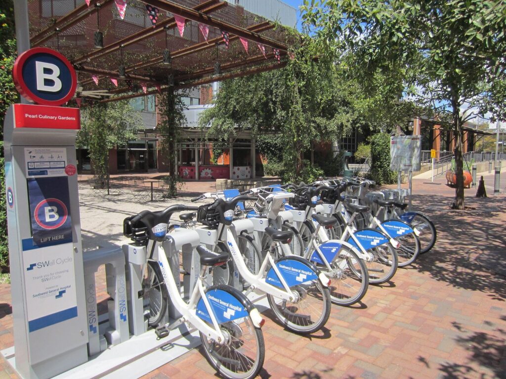
BCycle prices
| Pass | Price (Sept. 2026) | What you get | Good for |
|---|---|---|---|
| 1-Hour Pass | $15 | One trip of up to an hour | A single ride, such as downtown to the Pearl |
| Day Pass | $25 | Unlimited 1-hour trips for 24 hours | A missions ride with stops |
| Overage | $3.25 per extra 30 minutes | Charged if you keep a bike past the hour | Avoid by docking |
For visitors the math is easy: one ride, buy the hour; two or more, buy the day. Monthly ($33) and annual ($160) memberships exist for locals and long stays.
The Mission Reach Hike and Bike Trail
The trail along the Mission Reach is paved and out-and-back, not a loop, and it’s open sunrise to sunset. Each mission is about two to three miles from the next, and there are water fountains and restrooms along the way. Our guide to the San Antonio missions covers what to see at each stop. The missions themselves are free, with free parking at every one, and they’re also active parishes, so keep services in mind before you wheel up to the church door on a Sunday.
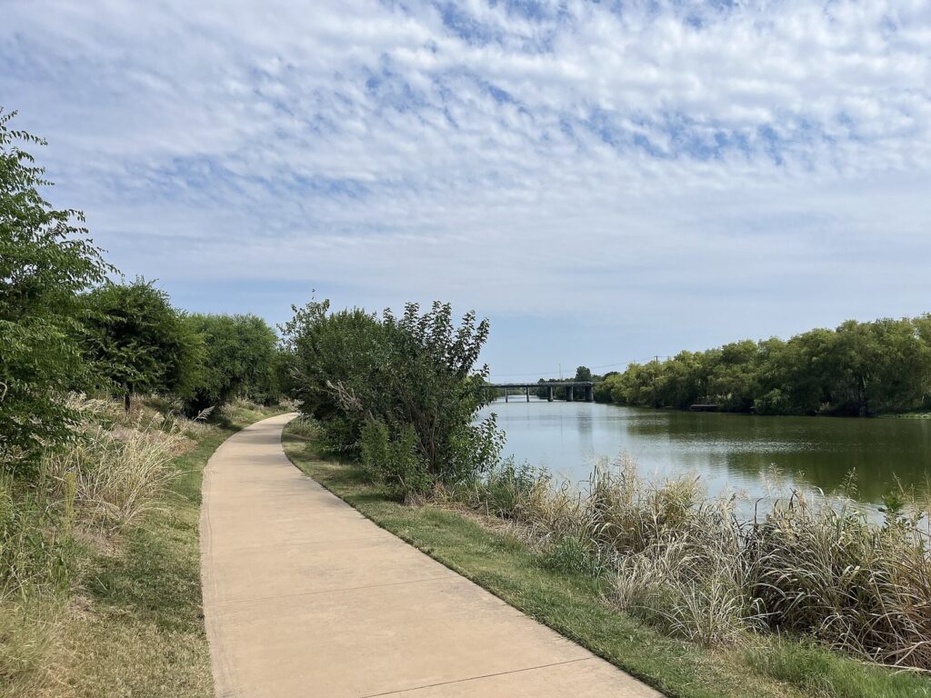
Start by 8 a.m. from late spring to early fall. The trail has long open stretches with little tree cover, and the e-bike’s motor helps with effort, not with sun. Riding the full out-and-back to Espada makes a long morning; turning around at San José roughly halves it and still covers the two missions most people rank highest. One more rule from the river’s managers: the Mission Reach can flood, so avoid it after heavy rain if the paths aren’t visible.
Rideshare, Taxis and Scooters
Uber and Lyft are the default once you’re past walking distance: evenings out, the McNay, the DoSeum and car-free theme park days. Two tips. The River Walk is below street level, so climb to a street address or hotel entrance before you request a car. And demand spikes when big events let out, such as Spurs games at the Frost Bank Center on the East Side, Fiesta parades and concerts, so either leave before the crowd or plan to walk a few blocks away from the venue to meet your ride.
Taxis are the other option, and the airport’s published metered rates, listed above, give you a sense of what a cross-town ride should cost. At the airport they’re often the quicker choice when the rideshare queue is long.
Rental e-scooters appear downtown under city permits. The city’s dockless rules keep them off sidewalks and off the River Walk, and news reports describe an overnight curfew and a minimum rider age of 16. Operators come and go, so check which apps are active when you arrive.
Driving and Parking in Downtown San Antonio
Driving is straightforward once you learn the rings and spokes. Loop 410 circles the inner city and Loop 1604 the outer suburbs, while I-35 heads northeast to Austin, I-10 northwest to the Hill Country and east to Houston, I-37 south to Corpus Christi, and US 281 north past the airport. Downtown is a tangle of one-way streets and construction detours, so park once and walk.
Where to park, and what it costs
| Where | What it costs (Sept. 2026) | Good to know |
|---|---|---|
| City lots and garages | $2 to $10 a day | Card only, per the City’s parking FAQ |
| City garages on Thursday evenings | Free, 5 p.m. to 2 a.m. | Runs through the end of 2026 |
| City Tower Garage | Free on Sundays | Handy for a Sunday River Walk day |
| St. Mary’s Garage | $5 after 5 p.m. weeknights and all weekend | Close to the River Walk’s west side |
| Street meters | $1.80 an hour, 2-hour limit | Enforced 8 a.m. to 6 p.m. Monday to Saturday; free outside those hours |
| The Alamo | No on-site parking | Use nearby public lots and garages |
| The Pearl | Surface lots free weekdays before 3 p.m.; $4 flat after 3 p.m. Monday to Thursday; $13 after 3 p.m. Friday and all weekend | First 30 minutes always free; the Koehler Garage charges by the hour |
| The missions | Free | Free parking at all four |
| Six Flags Fiesta Texas | General parking from $39 online | Preferred and valet cost more, plus fees |
Hotel valet costs far more than the city garages and is often the biggest argument against bringing a car. The River Walk’s official FAQ counts more than 2,000 meters nearby, and since they’re free after 6 p.m. and on Sundays, an evening visit by car can cost nothing if you find a space.
One traffic warning: every drive time in this guide is the free-flow best case. Rush hours on I-35, I-10 and Loop 410 add real time, and I-35 northeast toward New Braunfels and Austin is rarely free-flowing at all.
Getting to the Theme Parks, Caverns and the Edges of Town
San Antonio’s big family attractions sit well outside downtown, and none of them is a practical bus trip for visitors. Six Flags Fiesta Texas is at I-10 and Loop 1604 on the northwest side, 16.4 miles and 27 free-flow minutes from Alamo Plaza. SeaWorld San Antonio and Aquatica are further out on the west side, 18.4 miles and about 30 minutes. Natural Bridge Caverns is 27 miles northeast off I-35, with $10 parking. Morgan’s Wonderland, the fully accessible theme park, is about 12 miles northeast.
For one park day from a downtown hotel, a round-trip rideshare can compare well with a day’s rental plus $39 or more in Six Flags parking; for two or three park days, rent. Rideshare prices climb when a park empties at closing, so leave an hour early or wait out the first wave with dinner. Our San Antonio theme parks guide compares the parks themselves, and the family guide to San Antonio with kids helps you decide which days need a car seat and which don’t.
Day Trips: Where a Car Stops Being Optional
If you’re heading into the Hill Country or up the I-35 corridor, you need a car. Nothing else gets you to Fredericksburg, Luckenbach or Bandera on your own schedule. Here’s how far the common day trips are from Alamo Plaza in free-flowing traffic, from OpenStreetMap routing on September 23, 2026.
| Destination | Miles | Drive (free-flow) | Traffic note |
|---|---|---|---|
| Castroville | 26 | 33 min | West on US 90; usually easy |
| New Braunfels (Main Plaza) | 31 | 39 min | I-35; often slower, and New Braunfels is in Comal County, not Bexar |
| Boerne | 31 | 39 min | I-10 northwest |
| Gruene | 35 | 46 min | Same I-35 caveat as New Braunfels |
| Guadalupe River State Park | 40 | 56 min | Hill Country roads for the last stretch |
| Bandera | 47 | 66 min | Two-lane roads |
| San Marcos | 49 | 57 min | I-35; plan for delays |
| Wimberley | 62 | 77 min | Winding roads after I-35 |
| Lockhart | 67 | 73 min | Barbecue trip; go early |
| Fredericksburg | 70 | 80 min | I-10 then US 87; weekends get busy |
| Austin (Texas Capitol) | 79 | 92 min | I-35 traffic can add an hour |
| Enchanted Rock | 87 | 111 min | Go early; plan for crowds on weekends |
| Corpus Christi | 143 | 2 hr 28 min | I-37; long but simple |
| Houston | 195 | 3 hr 27 min | I-10; too far for a comfortable day trip |
Austin is the one day trip with a rail alternative, Amtrak’s daily Texas Eagle, though one train each way doesn’t suit every plan. Everything else on this list means driving or booking a tour.
Arriving or Leaving by Train
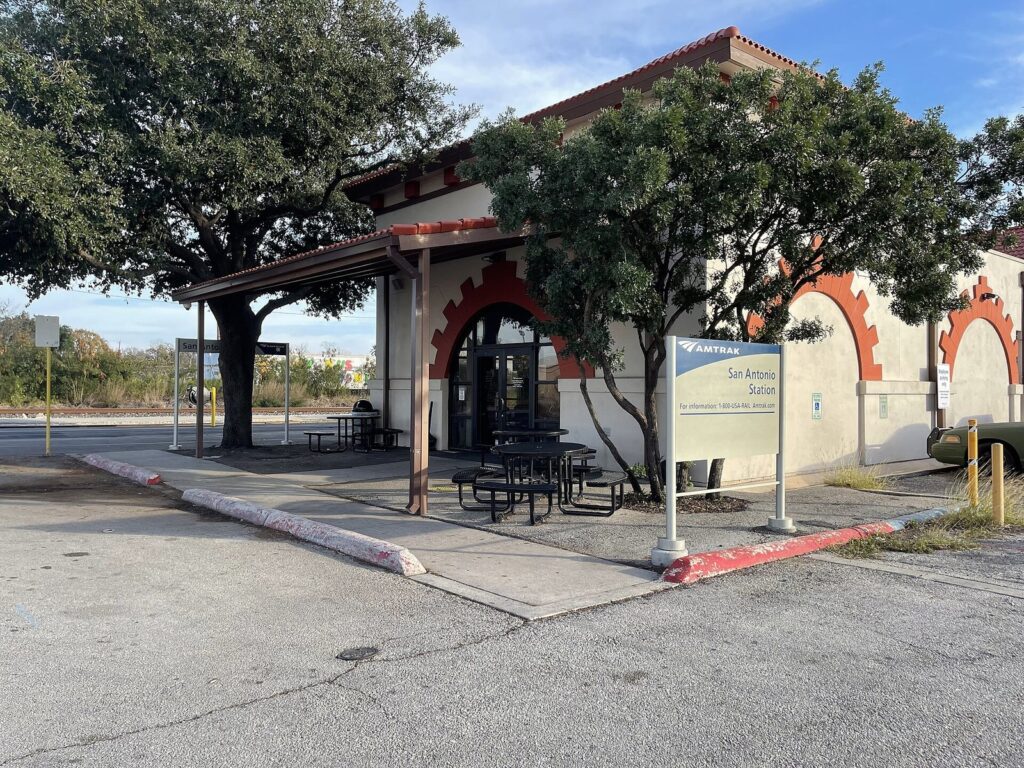
Amtrak serves San Antonio from a station beside the former Southern Pacific Sunset Station, east of downtown. The Texas Eagle runs daily to and from Chicago through Austin and Dallas, and the Sunset Limited links the city with Los Angeles and New Orleans three times a week. Through passengers between Chicago and Los Angeles lay over here for two to five hours while cars are coupled, which is enough time for a rideshare to the River Walk and dinner if you watch the clock.
Getting Around During Fiesta and Big Events
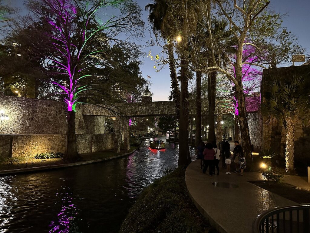
Big events reshape downtown traffic. Fiesta San Antonio 2027 runs April 15 to 25, and during its parades VIA detours buses around downtown; in 2026, the Battle of Flowers Parade on Friday, April 24 did exactly that. The River Walk’s holiday lights, switched on from November 27, 2026, fill the downtown loop every evening through early January. The City publishes a downtown events and street closures document for planning around parades and festivals.
On event days, park once, early, on the far side of downtown from the parade route, and walk. Expect rideshare surges when crowds leave, and meet your driver several blocks from the action. Our San Antonio events calendar has the dates, and a separate child guide will cover Fiesta transportation and parade-day detours.
Getting Around With a Wheelchair, Stroller or Limited Mobility
Downtown is more manageable than its two-level layout suggests, but plan the River Walk: some access points are stairs only. The City publishes three River Walk ADA maps, for the Museum Reach, the North Path and the River Bend, marking elevators, ramps, steps and stretches that aren’t accessible. The City’s Disability Access Office (210-207-7957) can send them. The new elevator at Paseo del Alamo, reopened July 2, 2026, is the simplest step-free link between Alamo Plaza and the river.
- Mobility rentals: Tom’s Wheelchairs (210-223-7878) rents mobility equipment downtown.
- San Pedro Creek Culture Park: built with 12,793 linear feet of ADA-accessible paseos, and a smoother route than parts of the older River Walk.
- VIA: alongside its regular routes, VIA runs VIAtrans, a paratransit service for eligible riders; check eligibility and booking rules with VIA before your trip.
Allow extra time around the Alamo while construction fencing lengthens short routes.
Heat, Rain and After Dark: Timing How You Move
NOAA’s 1991 to 2020 normals put average highs at 92.4°F in June, 94.9°F in July and 96.0°F in August, and September still averages 90.1°F. The city sees about 18 days a year at 100°F or hotter. That should shape how you move as much as where you go.
- Before 11 a.m.: walk and bike: the Alamo, the missions by BCycle, the long walk to the Pearl.
- Midday: go indoors or go by car. A rideshare for a two-mile hop in August is money well spent.
- Evening: return to the river, which is open 24 hours downtown and on the Museum Reach and at its best after sunset.
- After dark on the Mission Reach: don’t. It’s open dawn to dusk only.
Put together, a car-free visit works best as three kinds of day: the downtown core on foot, the Museum Reach north to the Pearl with a boat, bike or rideshare back, and the missions by BCycle on a cool morning. Our San Antonio itineraries turn those into full day-by-day plans, our San Antonio neighborhoods guide shows which parts of town hang together on foot, and the San Antonio food guide is organized by area, so lunch can be wherever you end up.
Getting Around San Antonio FAQ
Is Uber or a taxi cheaper from the airport?
It depends on the hour. The airport lists taxi fares to downtown areas starting at $24 to $29 per cab, for up to six people if the luggage fits, with a $1 night surcharge from 9 p.m. to 5 a.m. Rideshare prices move with demand, so compare the app quote with the taxi range at the curb. Groups and late arrivals often do better in a cab.
Can you get to Six Flags or SeaWorld without a car?
Yes, by rideshare or taxi, but not practically by bus. Six Flags Fiesta Texas is about 16 miles from Alamo Plaza and SeaWorld about 18. For a single park day, round-trip rideshares can cost less than renting a car and paying park parking, which started at $39 online at Six Flags in September 2026. For multiple park days, renting is usually cheaper.
Is there a streetcar or trolley downtown?
No. VIA’s current service list includes no streetcar or trolley, and older guides that mention one are out of date. The next big transit addition is the VIA Rapid Green Line, a rapid-transit route between the airport, downtown and Brooks that VIA expects to open in 2028. Until then, construction brings stop closures and detours along San Pedro Avenue.
Do I need cash for parking or the bus?
Not usually. City lots and garages are card only, according to the City’s parking FAQ. VIA takes tap-to-pay Visa, Mastercard, Discover and phone wallets, along with app tickets, goCards and cash; it doesn’t take American Express. The one catch is the day pass, which you can’t buy on board by card or phone.
What’s the best way to reach the missions without a car?
An e-bike. BCycle has stations at all four missions, and a $25 day pass covers unlimited one-hour trips, so you can dock and look around at each stop. VIA Route 42 is the bus alternative, but it only serves Concepción and San José. No bus reaches San Juan or Espada, so without a bike those two mean a rideshare.
Related San Antonio Guides
- San Antonio River Walk Guide: the reaches, boats, access points and when to go.
- San Antonio Missions Guide: what to see at each of the four missions and how long to allow.
- Where to Stay in San Antonio: the neighborhood you choose decides whether you need a car.
- San Antonio Theme Parks: Six Flags, SeaWorld and the rest, compared.
- San Antonio Itineraries: day-by-day plans that keep travel time down.
- Things to Do in San Antonio: the full list, with what’s worth your time.
Sources and How We Checked
Fares, schedules, prices, parking rules and distances in this guide were checked on September 23, 2026. The guide is compiled from the operators and agencies listed below rather than from other travel lists, and it does not claim first-hand visits; drive and walk times come from OpenStreetMap routing.
- VIA Metropolitan Transit: VIA home and service alerts, bus services, service changes
- San Antonio International Airport: public transportation, taxi cabs, rideshare, rental cars
- San Antonio BCycle: passes and stations
- City of San Antonio: downtown parking, River Walk accessibility maps and downtown events
- San Antonio River Walk: hours, FAQ, holiday lights
- The Alamo: visit information and Alamo Plan construction news
- National Park Service: San Antonio Missions National Historical Park
- Go Rio River Cruises: river shuttle and ticket booths
- Amtrak: San Antonio station, Texas Eagle, Sunset Limited
- Pearl: parking; Six Flags Fiesta Texas: parking; Witte Museum: directions
- San Pedro Creek Culture Park: park information
- NOAA National Centers for Environmental Information: 1991 to 2020 climate normals
San Antonio Tourism Guide is an independent publication. We are not affiliated with Visit San Antonio, the City of San Antonio, the Alamo or any attraction listed here, and no one paid to be included.
Photo Credits
- VIA bus at Market Square: photo by Han Zheng, Wikimedia Commons (CC BY-SA 2.0)
- San Antonio International Airport from the air: photo by — BQZip01 — talk, Wikimedia Commons (CC BY-SA 3.0)
- Houston and Jefferson streets: photo by Eden, Janine and Jim from New York City, Wikimedia Commons (CC BY 2.0)
- BCycle station at the Pearl: photo by Another Believer, Wikimedia Commons (CC BY-SA 4.0)
- Mission Reach hike-and-bike trail: photo by Michaelluckey, Wikimedia Commons (CC BY 4.0)
- San Antonio Amtrak station: photo by Ironmatic1, Wikimedia Commons (CC BY-SA 4.0)
- Downtown River Walk at night: photo by Mikael Häggström, Wikimedia Commons (CC0)