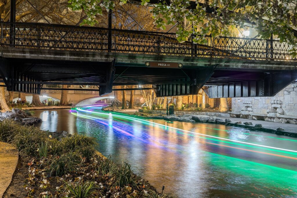
Here is the San Antonio River Walk map in words. The River Walk is a 15-mile path along the San Antonio River, about five miles of it downtown, and the downtown part sits roughly a story below the streets. In the middle, the river makes a tight loop a little under a mile around, closed on its west side by a short straight channel, with a branch running east to the Shops at Rivercenter and the convention center. North of the loop, the Museum Reach runs to the Pearl. South of it, the river slips under Villita and Nueva Streets on its way past King William to the Mission Reach and the Spanish missions. You can get down by stairs at nearly every bridge, but step-free access is limited to the 10 elevators and 7 ramps on the City’s downtown map.
This page is for anyone standing on a bridge wondering how to get down, pushing a wheelchair or stroller, or planning a walk from the Alamo to the Pearl. The catch is that nobody numbers the entrances, and the official maps are image files and PDFs of very different ages, so we’ve turned them into tables you can print. For what to do once you’re down by the water, start with our San Antonio River Walk guide. Everything here was checked October 1, 2026 against the City of San Antonio’s River Walk ADA maps, the River Walk’s own site, Go Rio River Cruises and the Alamo.
| Question | Short answer |
|---|---|
| Cost | Free to walk, and the maps are free to download. Boats, food and attractions cost extra. |
| Hours | Downtown and the Museum Reach: 24 hours. Mission Reach: dawn to dusk. |
| Size | 15 miles in all. The downtown loop is about 0.85 mile around, measured on the City’s map. |
| Time needed | 20 minutes to walk the loop without stopping, 2 to 3 hours with a meal and side trips, half a day for the Museum Reach and the Pearl |
| Time outdoors | All of it. Cypress trees and buildings shade much of the loop; the Mission Reach has little shade. |
| Best time to go | Before 10 a.m. or after sunset from June to September, when average highs run 92 to 96°F |
| Step-free access downtown | 10 elevators and 7 ramps on the City’s River Bend map, updated July 30, 2026 |
| Book ahead? | No. The paths are open to everyone; only reserved seats for river parades are sold in advance. |
How do you read a San Antonio River Walk map?
Start with the direction of flow. The San Antonio River runs north to south through downtown, so upstream means toward the Pearl and downstream means toward the missions. The City’s maps put north at the top, and that’s the easiest way to hold the whole system in your head: the Museum Reach at the top, the downtown loop in the middle, the Mission Reach trailing off the bottom.
Then add the second level. Downtown, the walkways run along both banks below the streets, and arched footbridges link the two sides. Street bridges cross overhead every block or two. So there are really two maps in play: the street grid you see from Alamo Plaza, and the river level, where street names show up only on bridges and signs. Most of the confusion visitors run into comes from mixing the two. A hotel can be “on the River Walk” and still have its river door on the far side of a bend from its front entrance.
The downtown loop
The core of the River Walk is a horseshoe bend of the river that everyone calls the loop. It leaves the main channel near the two Drury hotels, runs east along Crockett Street past Omni La Mansión del Rio and the Aztec Theatre, swings up to the Hyatt at its northeast corner, then heads south across Commerce and Market Streets to the Hilton Palacio del Rio and the Arneson River Theatre in La Villita. From there it turns west along Villita Street, past the Briscoe Western Art Museum and Hotel Contessa, and rejoins the main channel by the International Center at Dolorosa Street.
Measured along the City’s map, the walkway around the bend runs about 0.75 mile on one bank. The short straight channel on the west side, which runs past Main Plaza, closes the circle and makes a full circuit about 0.85 mile. That’s roughly 20 minutes at an easy pace if you don’t stop, which almost nobody manages.
The Rivercenter and convention center channels
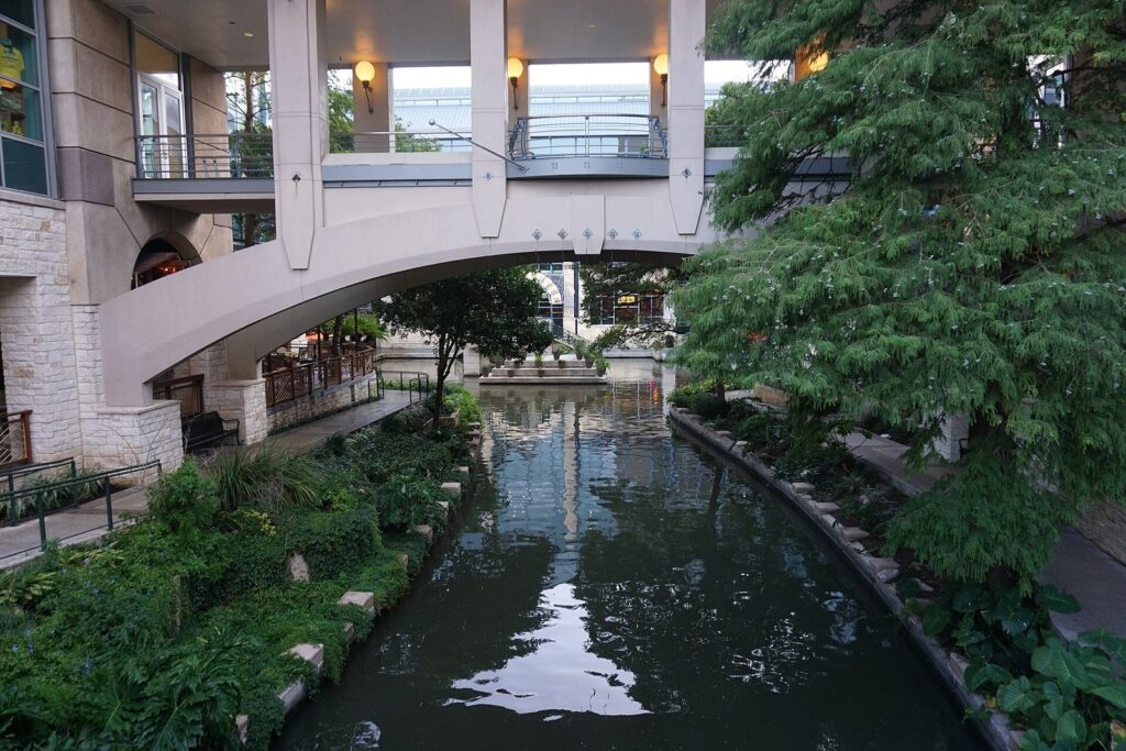
Two later additions branch east from the loop’s east side, between Commerce and Market Streets. A channel dug for HemisFair ’68 carried the river to the new convention center, and the Rivercenter extension of 1988 brought it to the mall. On the City’s map, the channel runs about 0.2 mile east to the Marriott Rivercenter. There a short arm ends at the Shops at Rivercenter, and a longer arm runs about 0.2 mile south to the Henry B. González Convention Center. It’s a dead end for walkers, but it’s also the most elevator-friendly corner of the River Walk.
North: the North Path and the Museum Reach
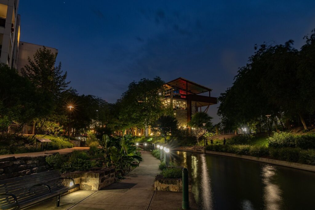
Above the loop, the main channel heads north past Hotel Valencia and Houston Street, then through a quieter stretch that the City’s maps call the North Path, past Hotel Havana, to the Lexington Avenue bridge beside the Tobin Center. That’s where the Museum Reach begins: 1.3 miles to the Pearl, open 24 hours, with the San Antonio Museum of Art past the halfway point and a lock at Brooklyn Avenue that raises and lowers boats about 9 feet. Look up under the I-35 overpass for F.I.S.H., Donald Lipski’s school of oversized fish hanging over the water.
South: King William, Blue Star and the Mission Reach
Below the loop, the river runs south under Villita and Nueva Streets, where the City’s downtown map ends with a ramp. Beyond that, the walkway follows the river past the King William Historic District and the Blue Star Arts Complex and turns into the Mission Reach: a restored, wilder river with a paved hike-and-bike trail that connects the four missions of San Antonio Missions National Historical Park. Unlike downtown, the Mission Reach closes at dusk and can flood, so treat it as a daytime trail and read our San Antonio missions guide before you head that way.
Where are the River Walk entrances?
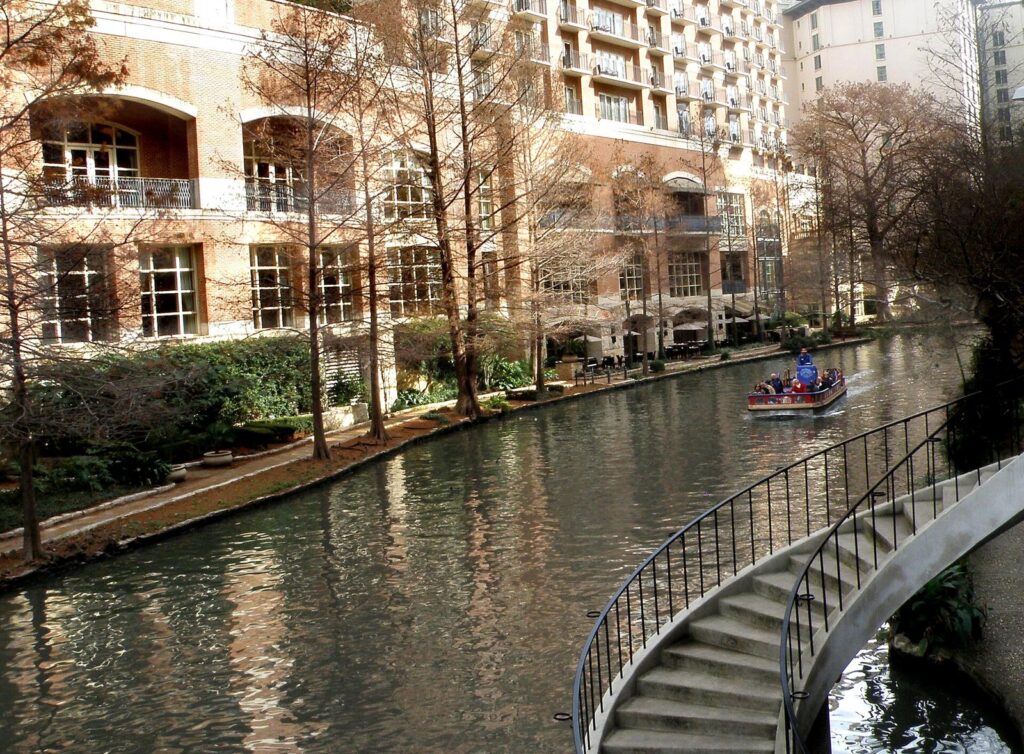
There are dozens of ways down and no official count. Most street bridges downtown have a stairway at one or more corners, many of them stone and some of them steep and narrow, and hotels, restaurants and the mall add their own. If you can manage stairs, the rule is simple: walk to the nearest bridge and look for the steps.
Step-free access works differently. The City’s Disability Access Office publishes a River Bend map of the downtown River Walk, last updated July 30, 2026. It marks the elevators and ramps it counts as accessible and draws the path that links them. It shows 10 elevators and 7 ramps. Here they are, matched to what you’ll see from street level.
| Access | Where to find it | Handy for |
|---|---|---|
| Elevator | Beside Hotel Valencia, near Houston Street | The north end of downtown and the walk toward the Museum Reach |
| Elevator | Beside the Drury Plaza hotel, on the west channel between the loop and Commerce Street | Hotels on the west channel and Main Plaza |
| Elevator | By the Mokara Hotel and the Aztec Theatre on Crockett Street | The north arm of the loop and the Aztec boat ticket booth |
| Elevator | At the Hyatt, at the river end of the Paseo del Alamo | Alamo Plaza |
| Elevator | Where Commerce Street crosses the loop’s east side | Commerce Street and the walk to Rivercenter |
| Elevator | Where the Rivercenter channel branches off the loop | Getting onto the channel toward the mall and convention center |
| Elevator | Near the Market Street bridge on the loop’s east side | La Villita, Hemisfair and the Arneson River Theatre |
| Elevator | At the Shops at Rivercenter end of the channel | The mall, the Marriott Rivercenter and Alamo Plaza beyond |
| Elevator | Inside the Henry B. González Convention Center, at the end of the south arm | The convention center; the City notes it may be closed during some events |
| Elevator | By the International Center, where the loop rejoins the west channel near Dolorosa Street | Main Plaza and the west side of downtown |
| Ramp | Main Plaza side of the west channel, at Commerce Street | San Fernando Cathedral and Main Plaza |
| Ramp | Dolorosa Street, just east of the International Center | Hotels along Dolorosa and Market Streets |
| Ramp | Beside the Briscoe Western Art Museum on Market Street | The Briscoe and Hotel Contessa |
| Ramp | Beside the Villita Assembly Hall in La Villita | La Villita’s shops and the Arneson River Theatre |
| Ramp | On the west channel near Nueva Street, south of the loop | The walk south toward King William |
| Ramp | Beside the Marriott Rivercenter | The mall and the Rivercenter boat booth |
| Ramp | At the convention center end of the south arm | Hemisfair and the convention center |
From Alamo Plaza: the Paseo del Alamo
The way down most visitors use is the Paseo del Alamo, the passage from the west side of Alamo Plaza to the top of the loop by the Hyatt. It reopened on July 2, 2026, after Alamo Plan construction, with a new welcome center and an elevator, which makes it the step-free link between the Alamo and the river. Expect fencing and work zones around the plaza itself while the Alamo’s construction continues. Our Alamo visitor guide covers tickets, timing and what’s open.
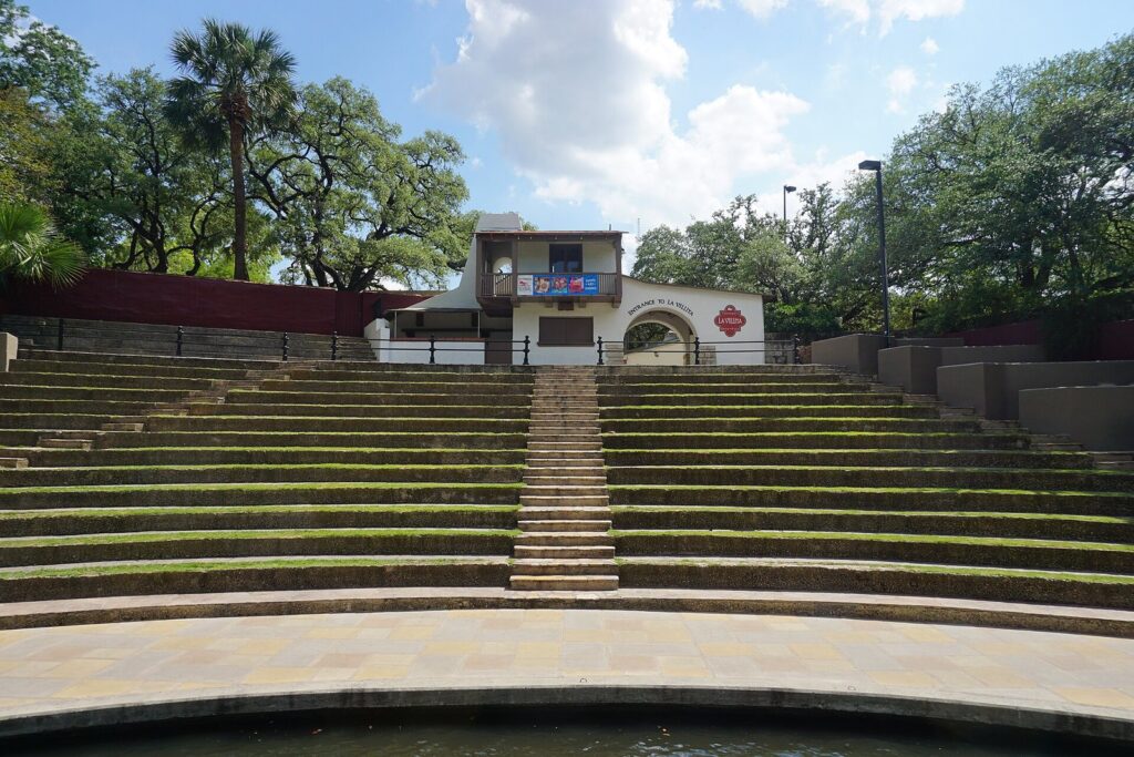
The dead end by the Arneson River Theatre
One note on the City’s map is worth reading before you set off with a wheelchair or a stroller. Near the Arneson River Theatre and the Hilton Palacio del Rio, the accessible path ends at a footbridge. The map’s advice is to turn back and take the ramp up to the upper River Walk level, about 150 feet behind you. The theater straddles the river, with grassy stone steps for the audience on one bank and the stage on the other, which is charming during a show and awkward on wheels.
Stairs-only stretches and private elevators
The map’s accessible line doesn’t cover every bank. In places it runs on one side of the river only, and the City’s accessibility page says plainly that some downtown access points are stairs only. The City says it has improved more than 50 River Walk locations since the early 1980s with ramps, pathways and, working with private businesses, elevators. Several sit in or beside hotels and the mall, and the convention center’s can close for events. If one is out of service, the next is rarely far. Between Commerce and Market Streets on the loop’s east side, three elevators sit within a few hundred feet of each other.
For questions, call the City’s Disability Access Office at 210-207-7957, which handles the ADA maps, or the City’s 311 line (210-207-6000). Tom’s Wheelchairs (210-223-7878) rents mobility equipment downtown. Go Rio says all of its barges are ADA-accessible, with boarding ramps and wheelchair spaces, which can turn a long push into a ride. Our accessible San Antonio travel guide covers the rest of the city.
Which River Walk maps should you download?
Three free maps are worth having, and they aren’t equally current.
The City’s River Bend ADA map
This is the one to print. It covers the loop, the west channel from above Houston Street down to Nueva Street, and the Rivercenter and convention center channels, with elevators, ramps, boat ticket stations and the accessible path drawn in, and hotels and landmarks labeled so you can match it to the street. It was updated July 30, 2026. The sheet is 11 by 17 inches, so set your printer to fit the page if you’re using letter paper.
The North Path and Museum Reach ADA maps
The same City page offers two more PDFs, and both are old. The North Path map, which covers the stretch between the loop and the Museum Reach, is dated July 2016. The Museum Reach map is dated January 2011 and still labels the Municipal Auditorium, since rebuilt as the Tobin Center for the Performing Arts, and the Havana Inn, now Hotel Havana. The river hasn’t moved, so it’s still a fair guide to the layout, but don’t rely on it for newer access points.
What the Museum Reach map shows: ramps every few blocks along an accessible path that runs nearly the full length, a ticket booth and restrooms at the Brooklyn Avenue lock, public restrooms at the Pearl, and a short stretch at the south end, near the Havana, that isn’t accessible. Near Jones Avenue and the San Antonio Museum of Art, the path ends twice on one bank. Heading north, you cross a bridge to a ramp on the other side of Jones Avenue; heading south, you cross a pedestrian bridge to a ramp on the opposite bank.
The River Walk’s own maps
The River Walk’s official site posts overall and downtown maps and parking maps, and it links to the City’s three PDFs. Use it for the big picture and parking, and the City’s maps for getting down to the water.
Phone maps
Phone maps work at street level, so the blue dot tells you which block you’re on, not which bank you’re walking. Tall downtown buildings can also push GPS off by a block. Two habits help. Note the street name on the bridge above you, and when you need one address for the River Walk itself, use the one the River Walk’s own FAQ gives: the Shops at Rivercenter, 849 E. Commerce St.
The River Walk map in one table, north to south
This is the printable version: each stretch in the order the river runs, with the landmarks you’ll see from the street and the step-free access the City’s maps mark. Print it with the River Bend PDF and you’re covered for downtown.
| Stretch | Runs between | Street-level landmarks | Step-free access | Open |
|---|---|---|---|---|
| Museum Reach | Lexington Avenue bridge to the Pearl, 1.3 miles | Tobin Center, Brooklyn Avenue lock, San Antonio Museum of Art at Jones Avenue, the Pearl | Ramps every few blocks; cross bridges at Jones Avenue where the path ends on one bank (2011 map) | 24 hours |
| North Path | Lexington Avenue south to Houston Street | Hotel Havana on Navarro Street | Mapped by the City in July 2016 | 24 hours |
| West channel, north | Houston Street to the loop split | Hotel Valencia, the Drury hotels | Elevators beside Hotel Valencia and the Drury Plaza | 24 hours |
| Loop, north arm | The split east along Crockett Street to the Hyatt | Omni La Mansión del Rio, Aztec Theatre, Mokara Hotel, Hyatt | Elevators by the Mokara and at the Hyatt (Paseo del Alamo) | 24 hours |
| Loop, east arm | The Hyatt south across Commerce and Market Streets | Rivercenter channel junction, Hilton Palacio del Rio | Elevators at Commerce Street, the channel junction and Market Street | 24 hours |
| Rivercenter channel | The loop east to the Marriott Rivercenter, then north to the mall and south to the convention center | Shops at Rivercenter, Marriott Rivercenter, Henry B. González Convention Center | Elevator and ramp at the mall end; elevator inside the convention center (may close for events) and a ramp at the end | 24 hours |
| Loop, south arm | The Arneson River Theatre west along Villita Street to Dolorosa Street | La Villita, Arneson River Theatre, Briscoe Western Art Museum, Hotel Contessa | Ramps by the Villita Assembly Hall and the Briscoe; footbridge dead end by the Arneson | 24 hours |
| West channel, south | The loop split past Main Plaza and the International Center, then south under Villita and Nueva Streets | Main Plaza, San Fernando Cathedral, International Center | Ramp at Commerce Street by Main Plaza; elevator and ramp at the International Center; ramp near Nueva Street | 24 hours |
| King William and Blue Star stretch | South of Nueva Street to where the Mission Reach begins | King William Historic District, Blue Star Arts Complex | Not on the City’s ADA maps | 24 hours |
| Mission Reach | South of downtown past the four NPS missions | Mission Concepción, Mission San José, Mission San Juan, Mission Espada | A paved hike-and-bike trail; mission trails link to it | Dawn to dusk |
Which way should you walk from the Alamo?
Many River Walk walks start at Alamo Plaza, so here are the common destinations, with the street route and the river route side by side. Street distances and times come from OpenStreetMap routing from Alamo Plaza. River distances downtown are measured along the accessible path on the City’s map, starting from the Paseo del Alamo elevator by the Hyatt.
| From Alamo Plaza to | On the streets | On the river | Our pick |
|---|---|---|---|
| The loop | Through the Paseo del Alamo on the plaza’s west side | You arrive at the top of the loop by the Hyatt | The Paseo, with its elevator |
| La Villita and the Arneson River Theatre | 0.4 mile, about 10 minutes | About 0.25 mile from the Hyatt down the loop’s east side | The river: about the same distance, in shade |
| Main Plaza and San Fernando Cathedral | 0.6 mile, about 13 minutes | About 0.27 mile from the Hyatt along the north arm and west channel to the Main Plaza ramp | The river, then up the ramp at Commerce Street |
| Shops at Rivercenter | About 0.3 mile | About 0.4 mile via Commerce Street and the Rivercenter channel | The streets if you’re in a hurry, the river if it’s hot |
| The Pearl | 1.5 miles, about 33 minutes | Longer: the North Path, then the 1.3-mile Museum Reach; allow 45 minutes to an hour | The river before 10 a.m., or the Go Rio river shuttle |
| King William | 1.4 miles, about 31 minutes | South down the west channel past Nueva Street | The streets are more direct; the river is the prettier way |
| Mission Concepción | 2.9 miles, about an hour | The Mission Reach trail, open dawn to dusk | A bike, or VIA Route 42, which serves Concepción and San José |
Which way round the loop?
Either direction works, and you can switch banks at the footbridges. From the Paseo del Alamo, turning south takes you past Commerce and Market Streets to La Villita, west along Villita Street, up the west channel past Main Plaza and back along Crockett Street to where you started. Wheelchair users should plan the south bend around the Arneson footbridge dead end.
Heat and shade
Heat shapes every route here. NOAA’s 1991 to 2020 normals put San Antonio’s average highs at 92 to 96°F from June through August, with about 18 days a year at 100°F or more. The loop is the shadiest part of the system. The Museum Reach has patchy shade, and the Mission Reach has long open stretches. In summer, walk the reaches before 10 a.m., save midday for the loop or for somewhere indoors, and carry water, because the trails beyond downtown have few places to buy it.
For buses, rideshares and parking around downtown, see our guide to getting around San Antonio.
Where are the boat stops on the map?
Go Rio River Cruises’ ticket booths double as landmarks. Go Rio lists three: Rivercenter (809 E. River Walk), Historia (706 River Walk) and Aztec (731 River Walk). The City’s map puts booths by the Aztec Theatre on Crockett Street, near Market Street by the Hilton Palacio del Rio, and by the Marriott Rivercenter. Go Rio says reservations aren’t needed for its public cruises; the narrated cruise lasts about 35 minutes. Its river shuttle runs from downtown to the Pearl daily from noon to 8 p.m., about once an hour, on 1-day and 3-day passes. That makes it a useful one-way ride if you walk up the Museum Reach in the morning and don’t want to walk back in the afternoon heat. Go Rio’s ticket site wasn’t loading when we checked, so confirm fares there before you go.
When does the River Walk map change?
The layout is fixed, but what’s open on it isn’t.
Floods. Locks and dams keep the downtown River Walk from flooding. The Mission Reach is different: the River Walk’s own guidance is to stay off it when the sidewalks aren’t visible. San Antonio’s wettest months are May, September and October, and storms there come hard and fast.
Parades. River parades fill the banks with reserved seating and slow everything around them. For the Ford Holiday River Parade, which starts at the Tobin Center at 6 p.m., free first-come viewing is on the east side of the River Walk between Pecan Street and Richmond Avenue; bring your own seat, and leave the stroller and the ice chest at the hotel, because neither is allowed. On parade nights, walk the opposite bank or stay at street level and cross on the bridges. Our San Antonio events guide has the dates.
Holiday lights. About 200,000 lights go up from November 27, 2026, on from sundown to sunrise into early January. December evenings bring big crowds to the loop, so the north arm and the west channel are good places to step out of the flow.
Construction. The Alamo Plan work around Alamo Plaza is the big one. The Paseo del Alamo route is open again, but fencing and detours on the plaza change as work moves.
Once you have the layout down, our guide to planning a River Walk day covers the best times, the boat question and what each reach is like.
San Antonio River Walk map FAQ
Is there a printable San Antonio River Walk map?
Yes. The best one is the City of San Antonio’s River Bend ADA map, a free PDF updated July 30, 2026, which shows the downtown loop with every elevator, ramp and boat ticket booth the City marks. It’s an 11-by-17-inch sheet. The City also offers North Path and Museum Reach PDFs, though those date from 2016 and 2011.
How many entrances does the River Walk have?
Nobody publishes a count. Most downtown street bridges have stairs at one or more corners, and hotels, restaurants and the Shops at Rivercenter add more. Step-free entrances are fewer: the City’s downtown map marks 10 elevators and 7 ramps, including the elevator at the Paseo del Alamo, the passage from Alamo Plaza that reopened in July 2026.
Is the San Antonio River Walk wheelchair accessible?
Much of the downtown River Walk is, but not every stretch. The City’s map shows the accessible path, 10 elevators and 7 ramps, and notes where it ends. The Museum Reach is accessible for nearly its full length on the City’s older map. Go Rio’s barges have boarding ramps and wheelchair spaces, and Tom’s Wheelchairs rents equipment downtown.
What address should you put in your GPS for the River Walk?
The River Walk’s own FAQ gives the Shops at Rivercenter, 849 E. Commerce St., which has an elevator down to the river. From the Alamo, skip the GPS: walk to the west side of Alamo Plaza and take the Paseo del Alamo, which comes out at the top of the loop by the Hyatt.
Are there public restrooms on the River Walk?
The City’s downtown map doesn’t mark any. Its older Museum Reach map shows public restrooms at the Brooklyn Avenue lock and at the Pearl. Downtown, the Shops at Rivercenter is the dependable option: it’s open Monday to Saturday from 10 a.m. to 8 p.m. and Sunday from 11 a.m. to 6 p.m., with holiday hours varying.
Related San Antonio Guides
- Accessible San Antonio Travel: step-free routes, rentals and access at the main sights beyond the river.
- The Alamo Visitor Guide: tickets, construction and how long to spend at the top of the Paseo del Alamo.
- Getting Around San Antonio: VIA buses, parking and rideshares for reaching the river.
- San Antonio Missions Guide: the four NPS missions at the end of the Mission Reach.
- Where to Stay in San Antonio: which River Walk hotels put you nearest the elevators.
- San Antonio Parks and Outdoor Adventures: biking and paddling the Mission Reach.
Sources and How We Checked
This guide was checked on October 1, 2026 and is compiled from the operators and agencies listed below, not from other travel lists. Distances described as measured were taken along the accessible path on the City’s River Bend map using its scale bar, and street walking times come from OpenStreetMap routing. It describes places from those sources and claims no first-hand visits.
- City of San Antonio, Disability Access Office: River Walk Maps and Accessibility, River Bend ADA map (PDF), North Path ADA map (PDF), Museum Reach ADA map (PDF)
- San Antonio River Walk: Maps, FAQs, Our History, Museum Reach, Ford Holiday River Parade, Holiday Lights
- Go Rio River Cruises: Visitor Information, Narrated Tours, River Shuttles, FAQ
- The Alamo: Alamo area construction news, July 2026
- National Park Service, San Antonio Missions: Physical Mobility
- VIA Metropolitan Transit: Route 42
- Shops at Rivercenter: Hours and directory
- NOAA National Centers for Environmental Information: San Antonio monthly normals, 1991 to 2020, annual normals
- OpenStreetMap: walking routes from Alamo Plaza
San Antonio Tourism Guide is an independent publication. We are not affiliated with Visit San Antonio, the City of San Antonio, the Alamo or any attraction listed here, and no one paid to be included.
Photo Credits
- River Walk at the Presa Street bridge: photo by Clyde Charles Brown, Wikimedia Commons (CC BY-SA 4.0)
- Rivercenter channel of the River Walk: photo by Michael Barera, Wikimedia Commons (CC BY-SA 4.0)
- Stairway down to the River Walk: photo by MARELBU, Wikimedia Commons (CC BY 3.0)
- Arneson River Theatre seating: photo by Michael Barera, Wikimedia Commons (CC BY-SA 4.0)
- Museum Reach path lights at night: photo by Corey Leopold, Wikimedia Commons (CC BY 2.0)